TRIP REPORTS: June - July 2023
23 July 2023 - Pukekohe |
Pukekohe, the name given by early Maori, translates as “hill of the kohekohe tree”
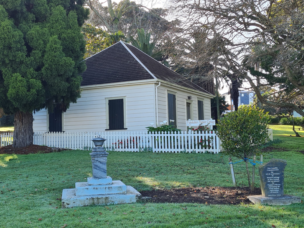
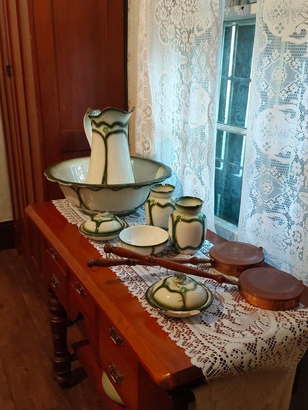
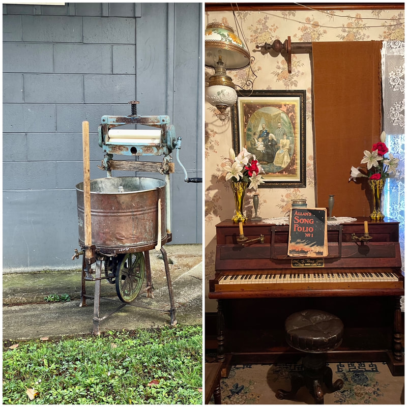
Our interesting day began with a visit to Pioneer Cottage in Roulston Park, Pukekohe. This lovingly preserved original cottage, built back in 1859, was gifted to the town and moved to its present site in 1965 to commemorate the centenary of Pukekohe. Brian and Jean, members of the Franklin Historical Society, spoke to us and showed us through the cottage. It was filled with the furnishings and belongings of early pioneer life and all beautifully presented. The story of Pukekohe’s former ostrich farming industry caught the eye.
Our interesting day began with a visit to Pioneer Cottage in Roulston Park, Pukekohe. This lovingly preserved original cottage, built back in 1859, was gifted to the town and moved to its present site in 1965 to commemorate the centenary of Pukekohe. Brian and Jean, members of the Franklin Historical Society, spoke to us and showed us through the cottage. It was filled with the furnishings and belongings of early pioneer life and all beautifully presented. The story of Pukekohe’s former ostrich farming industry caught the eye.
|
|
|
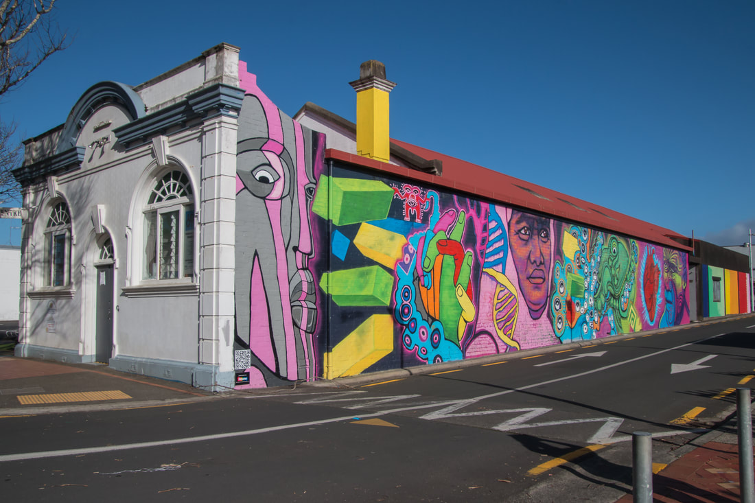
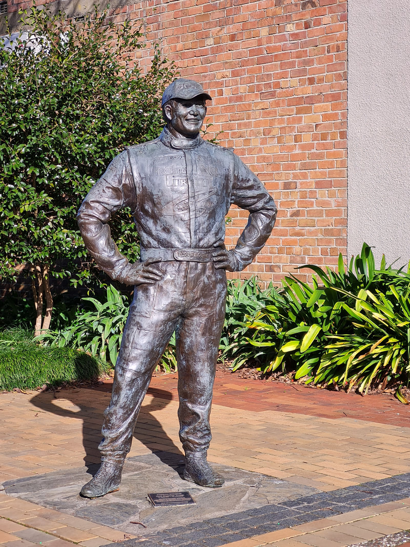
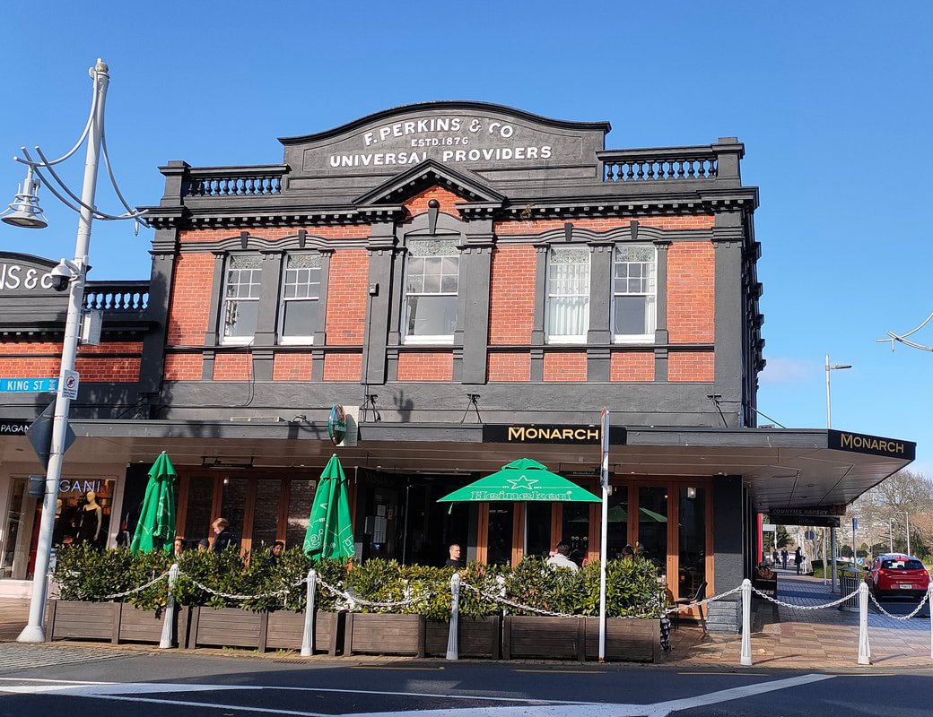
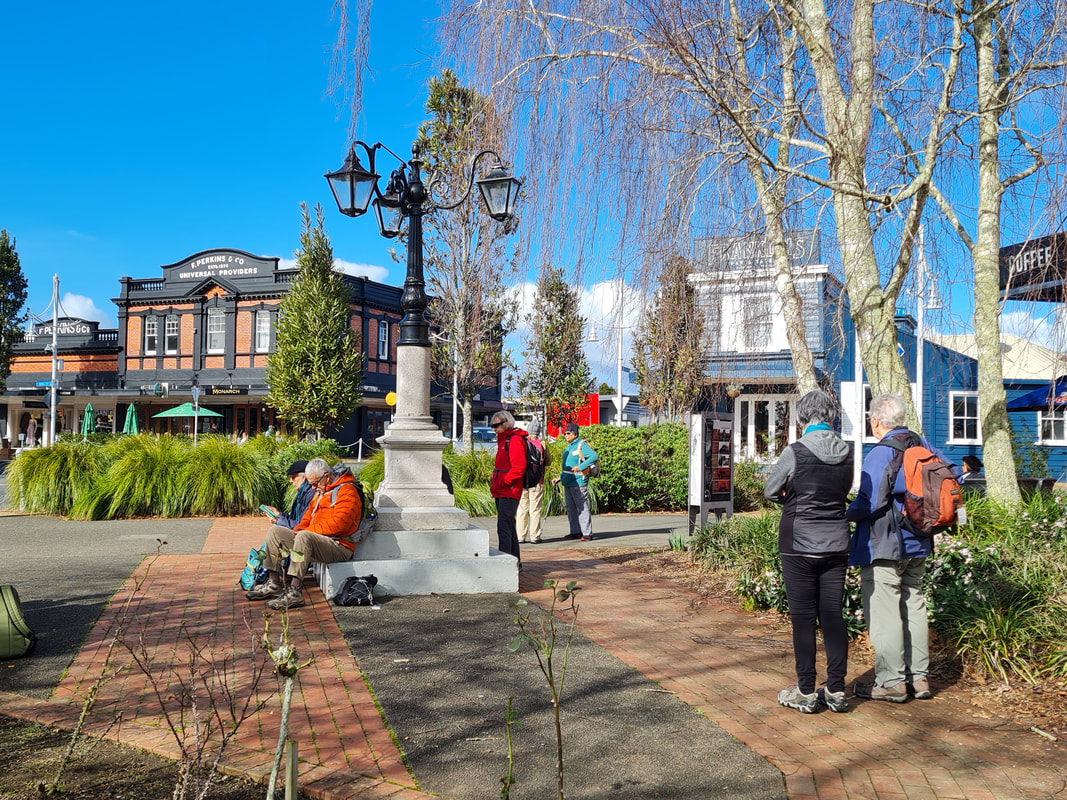
From the park, we took a route through the town centre, stopping to hear about some of the historical sites and buildings, admire the statue of Possum Bourne and various murals, and ending up at Seddon Park. Lots of history here, from the Seddon memorial lamps, the Judas tree and views across the road to the Perkins building (1908), now a cafe. |
|
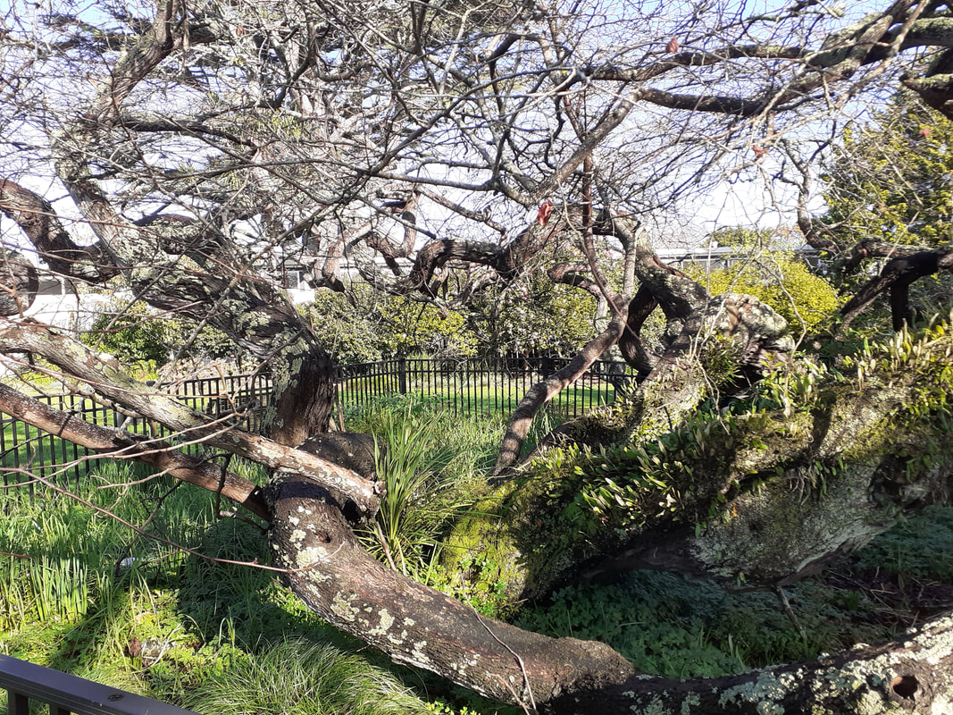
The story of the Judas tree captured our interest. The tree grew from seed collected in the Sangro Valley, Italy, during WW2 by a New Zealand soldier, Sam Allen. A New Zealand Notable Tree, its gnarly branches are now propped up and it is surrounded by a protective fence. Even more worth a visit in Spring when its bright pink/purple flowers burst forth.
The story of the Judas tree captured our interest. The tree grew from seed collected in the Sangro Valley, Italy, during WW2 by a New Zealand soldier, Sam Allen. A New Zealand Notable Tree, its gnarly branches are now propped up and it is surrounded by a protective fence. Even more worth a visit in Spring when its bright pink/purple flowers burst forth.
|
|
|
it
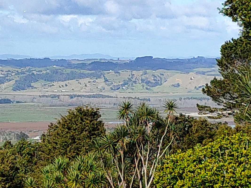
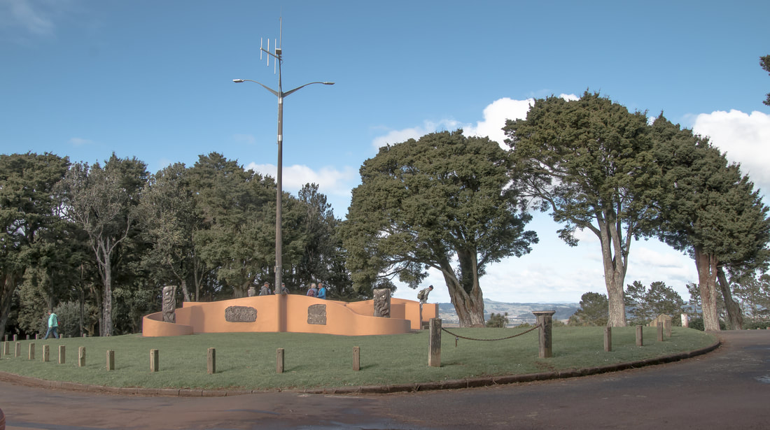
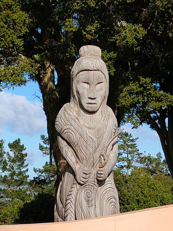
Our next stop was Pukekohe Hill (thankfully delivered up to the top by our bus as it was quite a distance uphill). A perfect spot for lunch and to admire the many beautiful carvings incorporated into the memorial there. The volcanic cone is part of the Pukekohe Five Summits Trail that can be walked. The club has now been to four of the summits at various times.
Our next stop was Pukekohe Hill (thankfully delivered up to the top by our bus as it was quite a distance uphill). A perfect spot for lunch and to admire the many beautiful carvings incorporated into the memorial there. The volcanic cone is part of the Pukekohe Five Summits Trail that can be walked. The club has now been to four of the summits at various times.
|
|
|
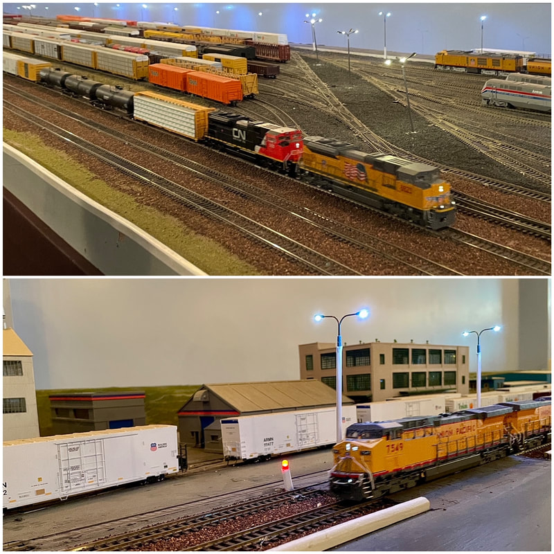
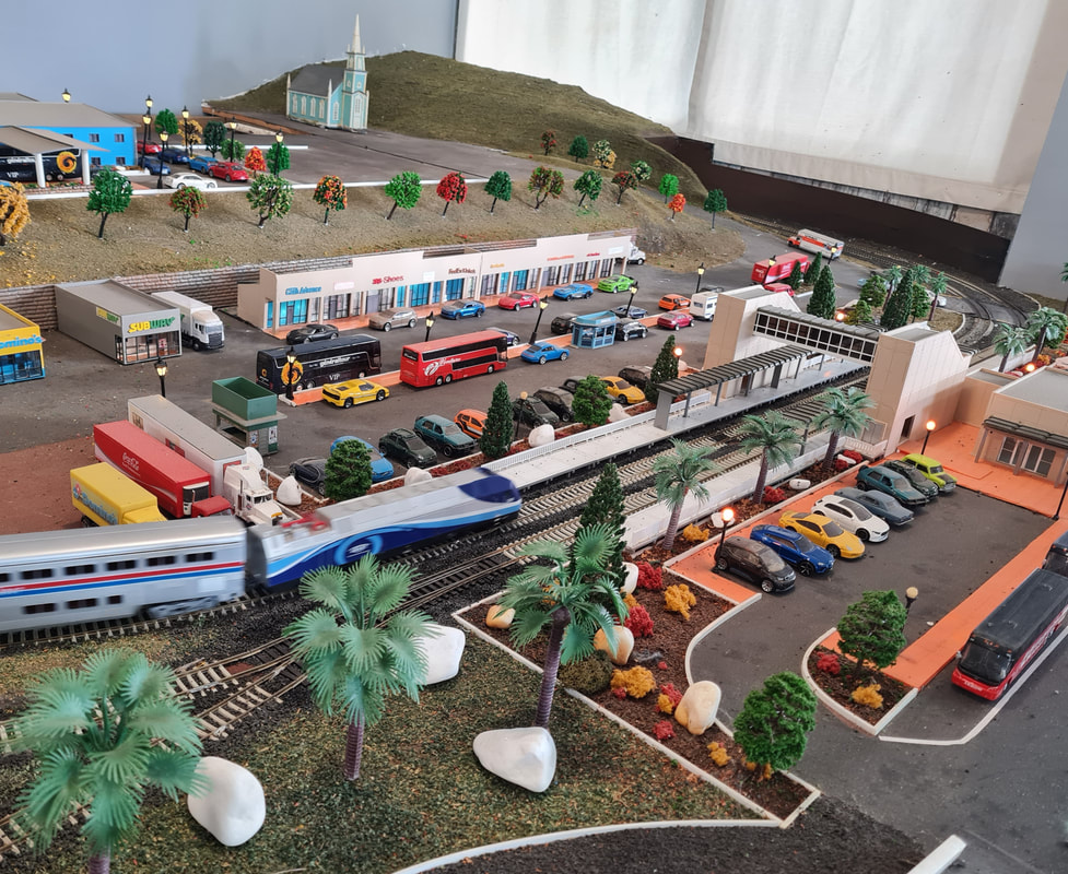
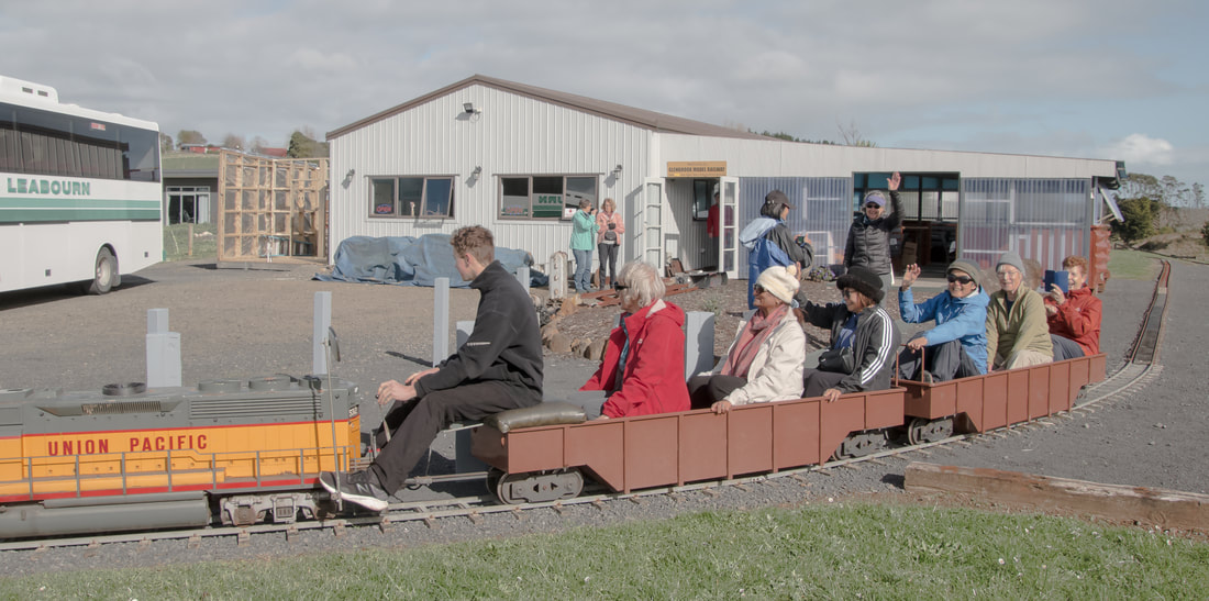
On the drive to our next stop it was hard not to admire the rich volcanic soil that grows Pukekohe’s marvellous potatoes, onions and more. We were en route to the Glenbrook Model Railway, a family run business in Morley Road, Waiuku. Owner Bob was very welcoming and hospitable and we all enjoyed experiencing the extensive network of model trains, tunnels, spirals and buildings. There was even a chance to be kids again and have a ride on a miniature train! A visit to be recommended.
https://www.facebook.com/glenbrookmodelrailway/
https://www.facebook.com/glenbrookmodelrailway/
|
|
|
Special thanks to ex-President Derek and to John for organising this great day out, and thanks Derek for the afternoon tea as well. We are also grateful to the members of the Franklin Historical Society for the morning walk and talk.
Text: Sharleen
Photos: Thanks to Barbara, Catherine, Sharleen
9 July 2023 - Moire Park and Manutewhau Walkways
 "Evading the rain "most of the time".
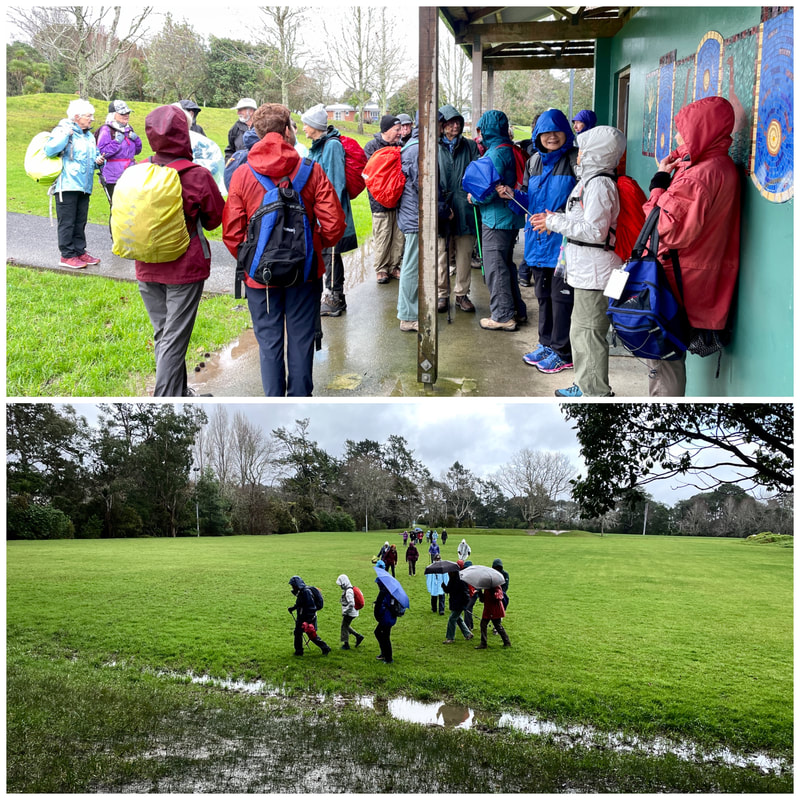
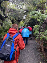
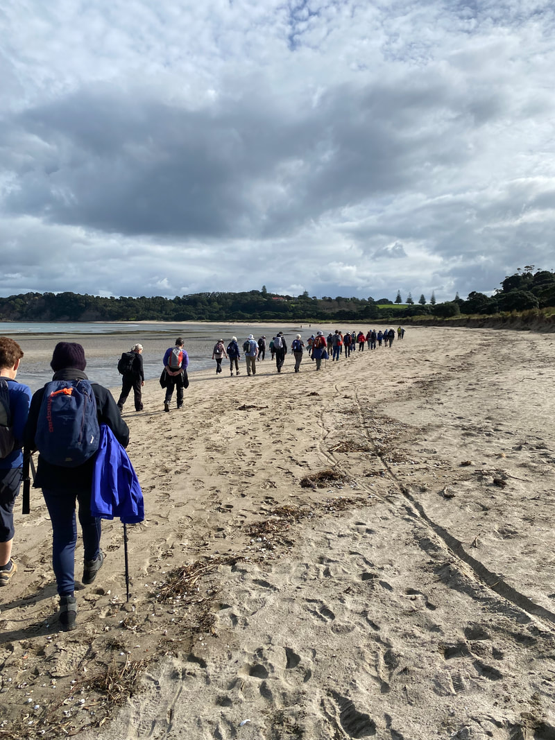
A mainly gentle undulating walk today where rain fortunately evaded the 29 of us, for "most of the time".
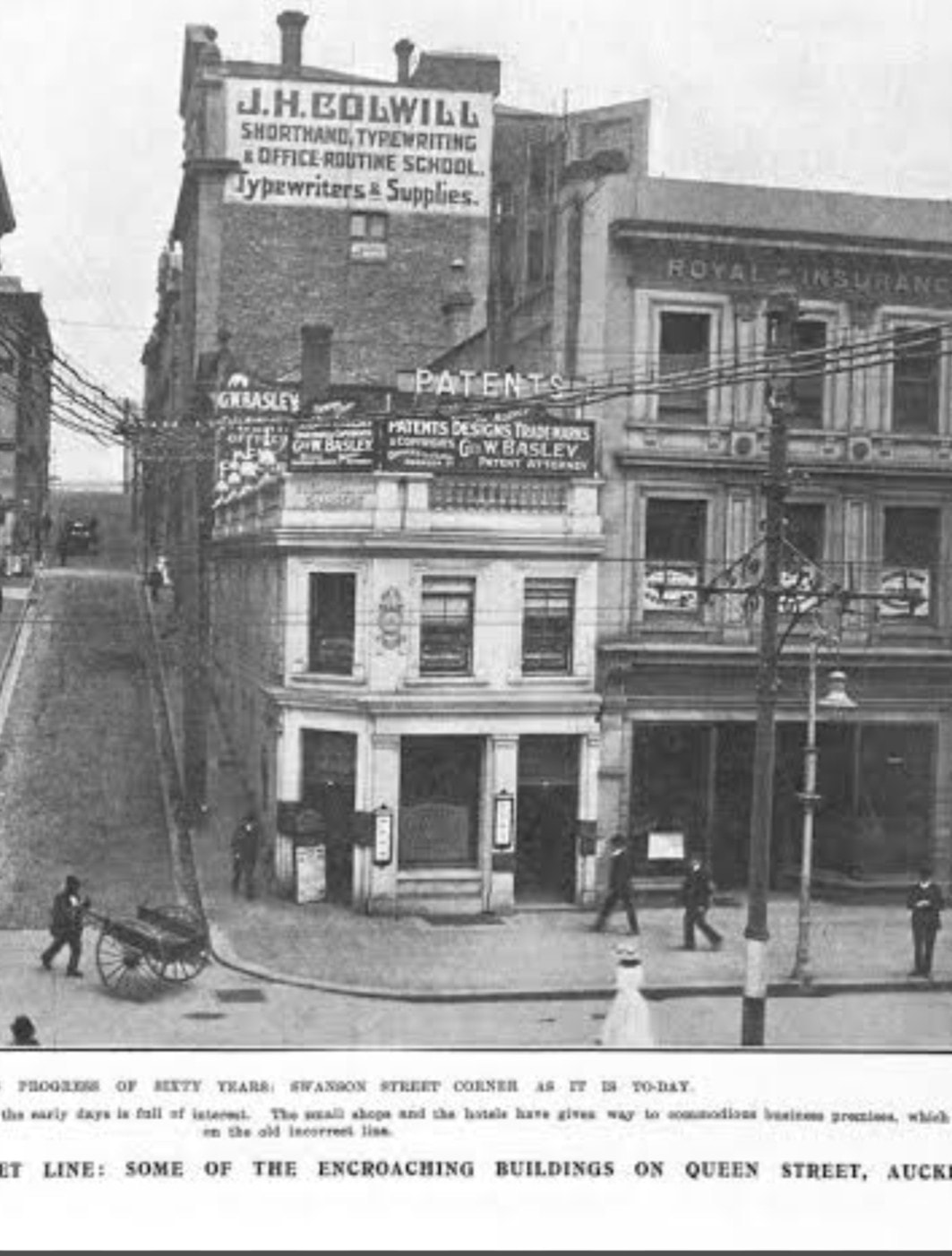
We parked at Moire Park, Granville Rd, Massey and headed through Auckland Council's signposted Manutewhau Walkways to lunch at Royal Reserve, via Rush Creek, where co-leader Catherine, discussed the connection with Henry Colwill, pioneer of Hobsonville-Massey area.
A mainly gentle undulating walk today where rain fortunately evaded the 29 of us, for "most of the time".
We parked at Moire Park, Granville Rd, Massey and headed through Auckland Council's signposted Manutewhau Walkways to lunch at Royal Reserve, via Rush Creek, where co-leader Catherine, discussed the connection with Henry Colwill, pioneer of Hobsonville-Massey area.
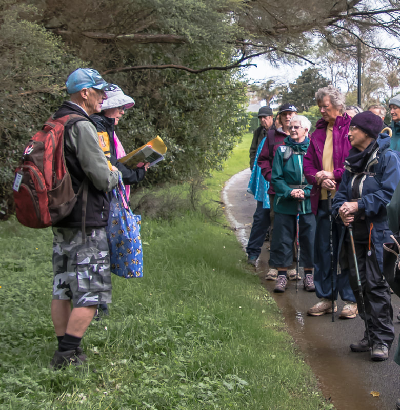
Back along to the bright yellow State Highway 16 bridge at Westgate then along to Flaunty Reserve where co-leader Bruce talked about the geology of the higher ground right underneath where we were standing being only 20 million years old and that dinosaurs died out approximately 65 million years ago |
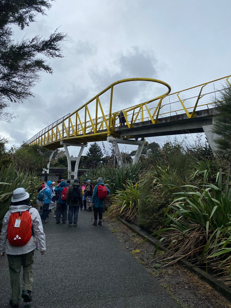 State Highway 16 Bridge State Highway 16 Bridge
|
Right on cue as we were getting into our cars at 2.30pm there was a heavy downpour, the ANHWC members had escaped the rain once again.
Special thanks to Catherine and Bruce, our leaders, for introducing us to their neighbourhood.
Text: Catherine
Photos: Barbara
Text: Catherine
Photos: Barbara
18 June 2023 - Rangitoto Island
A Walk
19 Club members headed to Rangitoto Island on an overcast day, by Fuller’s ferry. After an intro on the history and some details about the island by Sandra and facts about the eradication of possums and wallabies by Margaret Bol, we split into two groups. Group A, consisting of 10 walkers, headed to the summit with Sandra. The remaining 9 walkers, in Group B, set out to walk the foreshore track with Praemi.
19 Club members headed to Rangitoto Island on an overcast day, by Fuller’s ferry. After an intro on the history and some details about the island by Sandra and facts about the eradication of possums and wallabies by Margaret Bol, we split into two groups. Group A, consisting of 10 walkers, headed to the summit with Sandra. The remaining 9 walkers, in Group B, set out to walk the foreshore track with Praemi.
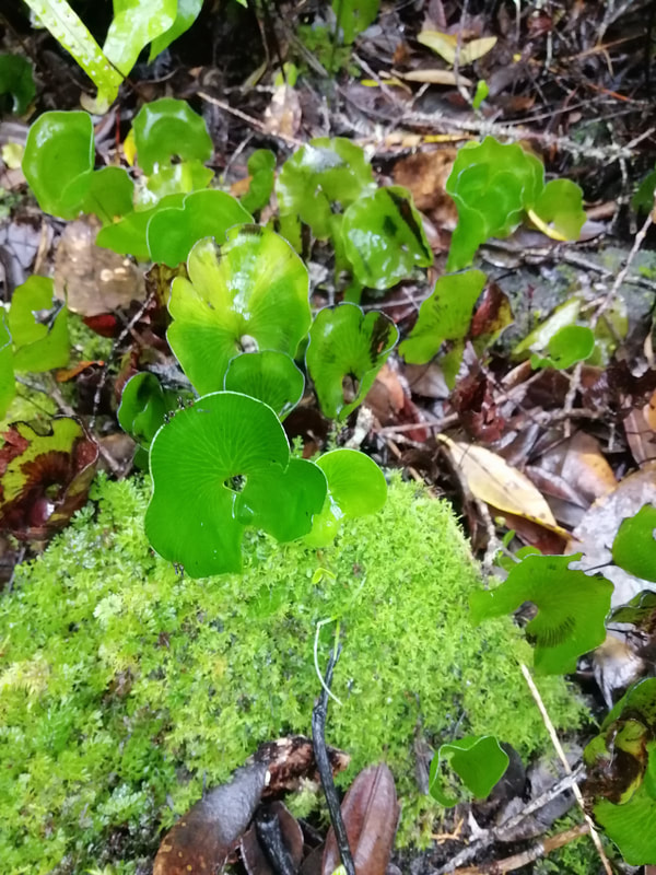
GROUP A’s walk was in 3 sections - Up, Down and Around. The first hour or so we climbed steadily upwards on the Summit Track, through the largest pohutukawa forest in New Zealand, noting the variety of smaller plants growing under the pohutukawa canopy. Part way up we had to don our raincoats when the first shower of the day came over. Once at the top, we spent about 20 minutes enjoying the views from the summit. The city and islands were clear, under a dramatic sky of black clouds. A concrete bunker at the summit is a reminder of the time when the military manned an observation point on Rangitoto before and during WWII. We spied 3 Californian quail huddled together under some bushes beneath the viewing platform, which were drawing lots of interest.
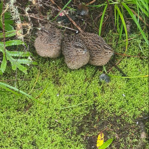
Young California quail.
|
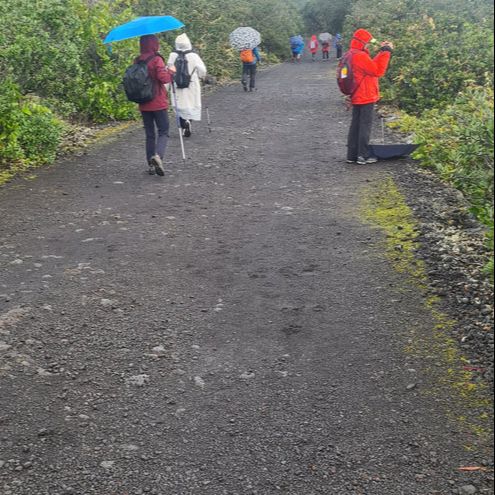
Happy even walking in the rain!
|
Another viewing platform near the summit gives a great view of the massive main crater, which is now clothed in dense green bush. At 60 metres deep and 150 metres across, it is impressive. There are 3 other craters near the top of Rangitoto Island and together they give the Island it’s distinctive shape, which is the same from whichever direction it is viewed.
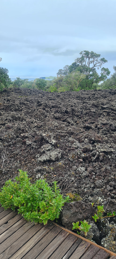
What goes up must come down, so we headed off on a long series of steps & boardwalks and then a road, leading down to McKenzie Bay. There was quite a lot of manuka on this side of the island and we were enchanted to hear fantail & saddleback. We had our lunch amongst black lava boulders on the beach, until the rain returned and encouraged us to move along.
What goes up must come down, so we headed off on a long series of steps & boardwalks and then a road, leading down to McKenzie Bay. There was quite a lot of manuka on this side of the island and we were enchanted to hear fantail & saddleback. We had our lunch amongst black lava boulders on the beach, until the rain returned and encouraged us to move along.
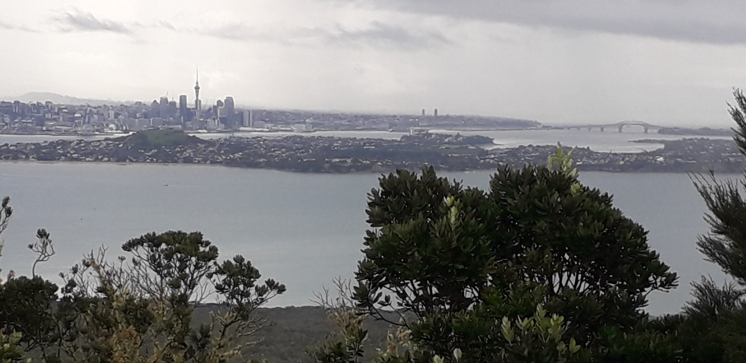
Auckland City and the Harbour Bridge from Rangitoto.
The last section followed the foreshore of the Island, from the red & white striped lighthouse back to the wharf. It took about 1 1/2 hours and rained most of the way. The bush gave way to a large area of coastal mangroves, interestingly they were growing out of rock - the only place they do that apparently. The views across to the North Shore and Eastern suburbs were lovely and the walk finished with a 15 minute track that ran along in front of some of the old baches, remaining on the Island from the 1920’s and 30’s.
We had about half an hour to rest and start the drying out process, before our ferry arrived. There was a real downpour while we were on the boat, and we felt very glad to be on board and under cover. One benefit of the rain was a beautiful bright rainbow that hung in the sky for ages, one end on land and the other sinking into the sea. It even had a second paler rainbow alongside for a while. A lovely end to our day.
We had about half an hour to rest and start the drying out process, before our ferry arrived. There was a real downpour while we were on the boat, and we felt very glad to be on board and under cover. One benefit of the rain was a beautiful bright rainbow that hung in the sky for ages, one end on land and the other sinking into the sea. It even had a second paler rainbow alongside for a while. A lovely end to our day.
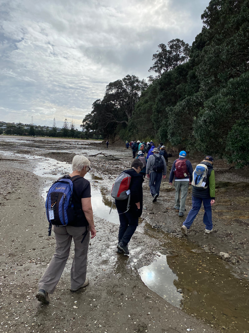
B Walk
Nine walkers (a few more than expected!) set off on the way to Islington Bay in a hopeful mood, with no rain in sight. On the way we took our time “botanising,” because this walk was the best opportunity to show newcomers how the vegetation of Rangitoto had developed from a scarred, bare landscape to a thriving pohutukawa forest interspersed with so many other native species.
<-- A few plants struggling to get a toe- hold beside a track (foreground).
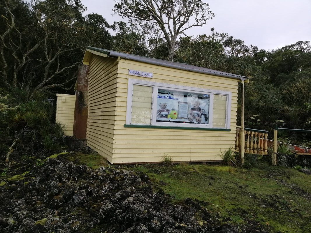
The bach known as "The doll's house."
But first we passed a few old baches, some looked as if they were still lived in. Due to a later than expected start (due to blocked toilets near the wharf!) we decided to take the inland route instead of the coastal route. However, the rain started much sooner than expected and was quite heavy, so instead of going on, only to see more of what we had already seen, we turned back and headed for shelter.
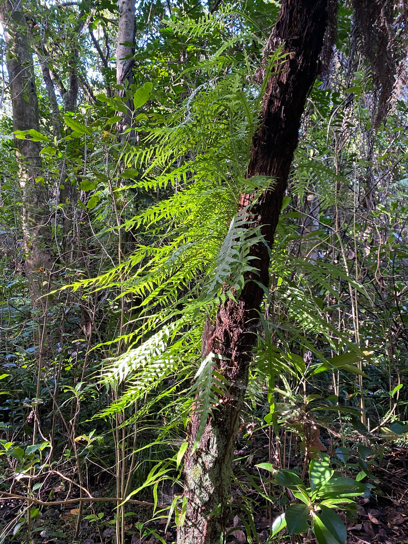
 Kidney fern and masses of mosses.
After a break for an early lunch, we set off into the famous Fern Glen but alas, access was quite difficult, with trees growing across and just above head height in many places. Again, we had to turn back, this time due to the track being rather dangerous to negotiate. However, it was good to see the forest growing back so well in this environment, with so little pollution.
We then did the short boardwalk through the area of mangrove growing right next to the lava flows, with a good supply of Salicornia pacifica next to the water’s edge. The Salicornia is important to the development of mangroves, because it releases some of the oxygen it absorbs from the air into the mud in which it is growing, through its roots. It thus provides other plants struggling in these highly saline conditions with an essential supply of air.
We then did the short boardwalk through the area of mangrove growing right next to the lava flows, with a good supply of Salicornia pacifica next to the water’s edge. The Salicornia is important to the development of mangroves, because it releases some of the oxygen it absorbs from the air into the mud in which it is growing, through its roots. It thus provides other plants struggling in these highly saline conditions with an essential supply of air.
One of the largest baches. I Ngaio growing out of scoria, close to the shore. I The "Show Home."
Finally we went past the wharf towards several more old baches, one of which is kept open in summer by volunteers. Here again, we could see a variety of trees that had sprung up out of the scoria. As the rain had set in again, we decided to catch an earlier ferry than expected and returned on the 2:30 pm sailing, content with our shortened day.
A big thanks to Sandra for organising the day and leading the 'A' walk.
Text: Sandra and Praemi
Photos: Heather, Jennifer, Praemi and Shuk
Text: Sandra and Praemi
Photos: Heather, Jennifer, Praemi and Shuk
4 June 2023 - Shakespear Regional Park
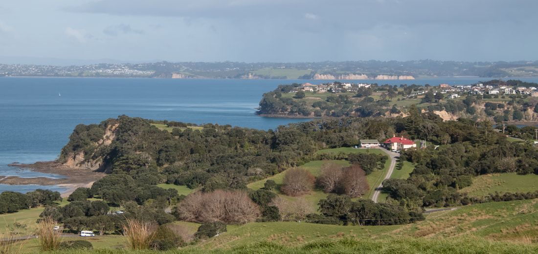
Situated at the end of the Whangaparāoa Peninsula Shakespear Park, an open sanctuary with 17 km of predator proof fencing is also a working farm.
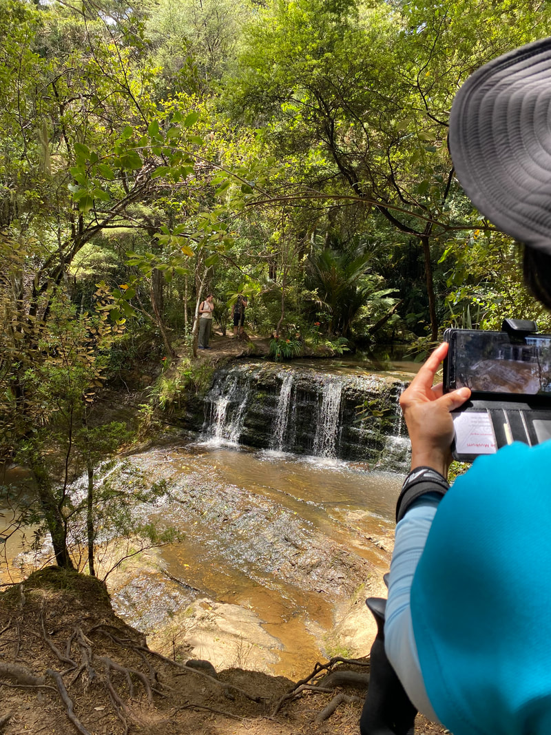
Starting at Army Bay 37 members walked on the Heritage Trail through Waterfall Gully on well developed tracks and boardwalks in a regenerating native forest with towering trees (puriri, kahikatea, kōwhai), ferns, fungi, streams and the waterfall. kererū, tūī, and bellbirds live here.
Climbing out of the gully up onto the hills with open farmland, we reached the lookout, viewing platform passing sheep and cattle grazing enroute. From here we had amazing 360 degree panoramic views of the Hauraki Gulf islands, Wenderholm, Mahurangi Regional Parks and Auckland city, especially good on a fine sunny day.
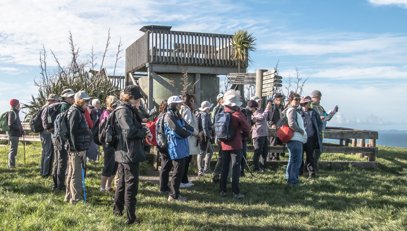
Following morning tea we joined the Tiritiri Track, walking beside the fence line of the Defence Force land and camp. From Pink Beach we had great views over to Tiritiri Matangi Island and the lighthouse. A point of interest was the degaussing station which was part of our defence alert system in wartime.
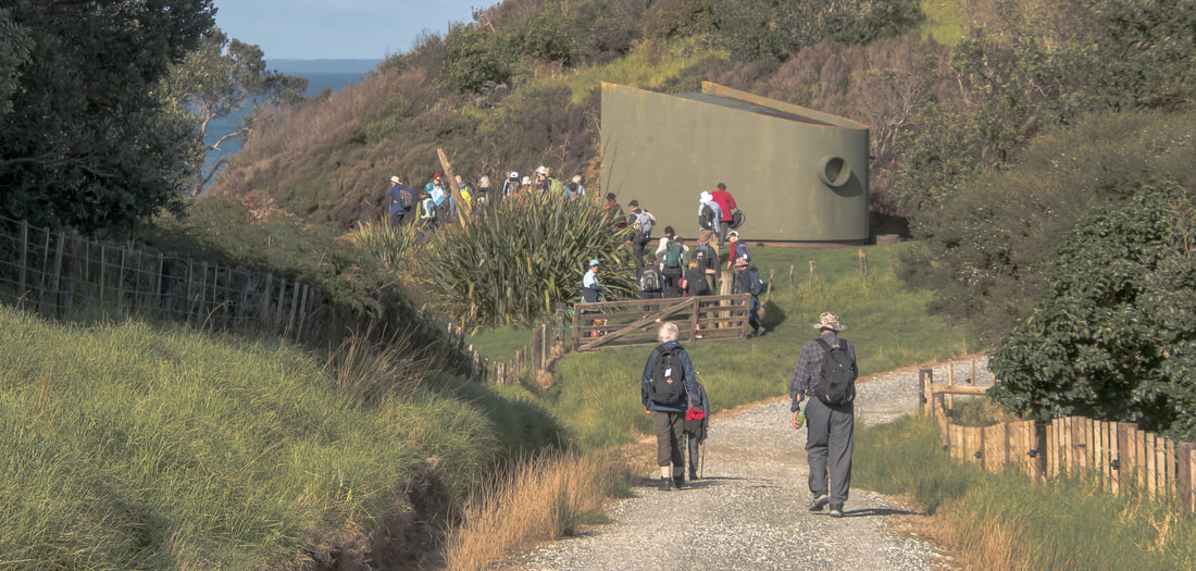
Continuing on the wide gravel road we descended to Te Haruhi Bay for lunch either in the picnic area or by the beach. Numerous pūkeko were around scavenging for food.
We followed the beach to the end before rejoining the grassed area and entering the bush to climb up the Okoromai Track. There were great views looking back along the beach we had been on previously. Again we tramped through native bush before returning to open farmland.
We followed the beach to the end before rejoining the grassed area and entering the bush to climb up the Okoromai Track. There were great views looking back along the beach we had been on previously. Again we tramped through native bush before returning to open farmland.
f
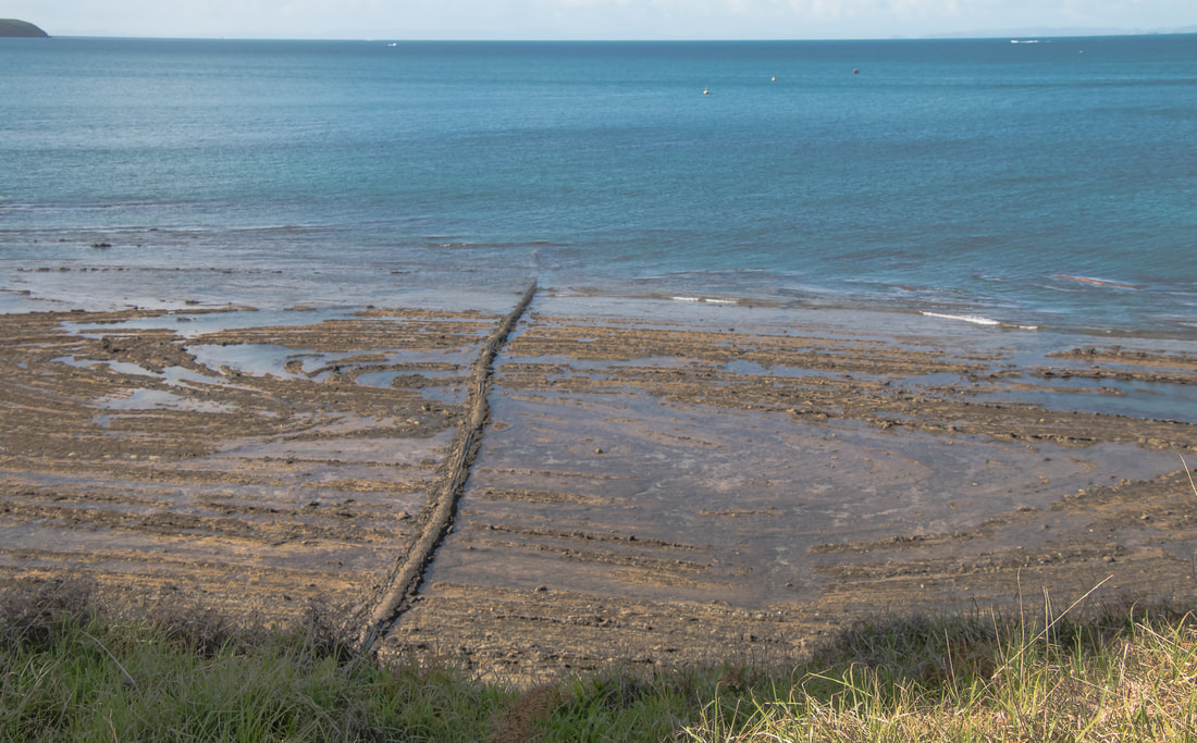
Passing through the predator proof fence gates we went down to the tidal flats of Okoromai Bay and as the tide was well out we strolled along the rocks. A few sea birds could be seen feeding well in the distance.
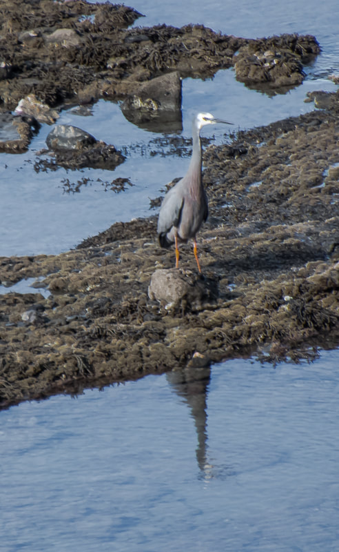
Our final distinct landscape to traverse was the wetlands. The track led us through swampy areas with flaxes and shrubs. We were delighted to see a large flock of over 20 tūī feeding on eucalyptus flowers. Once disturbed they flew away but quickly returned. A white faced heron in the water close by provided wonderful photo opportunities for our members.
Completing the loop we returned to Army Bay and our bus.
Many thanks to today's leaders - Fiona, Sandra and Jan.
Text: Jan Photos: Barbara and Linda
Passing through the predator proof fence gates we went down to the tidal flats of Okoromai Bay and as the tide was well out we strolled along the rocks. A few sea birds could be seen feeding well in the distance.
Our final distinct landscape to traverse was the wetlands. The track led us through swampy areas with flaxes and shrubs. We were delighted to see a large flock of over 20 tūī feeding on eucalyptus flowers. Once disturbed they flew away but quickly returned. A white faced heron in the water close by provided wonderful photo opportunities for our members.
Completing the loop we returned to Army Bay and our bus.
Many thanks to today's leaders - Fiona, Sandra and Jan.
Text: Jan Photos: Barbara and Linda