Trip Reports: February - March 2019
31 March 2019
Kiwi Esplanade / Ambury Regional Park / Mangere Lagoon / The Outdoor Gallery
Kiwi Esplanade / Ambury Regional Park / Mangere Lagoon / The Outdoor Gallery
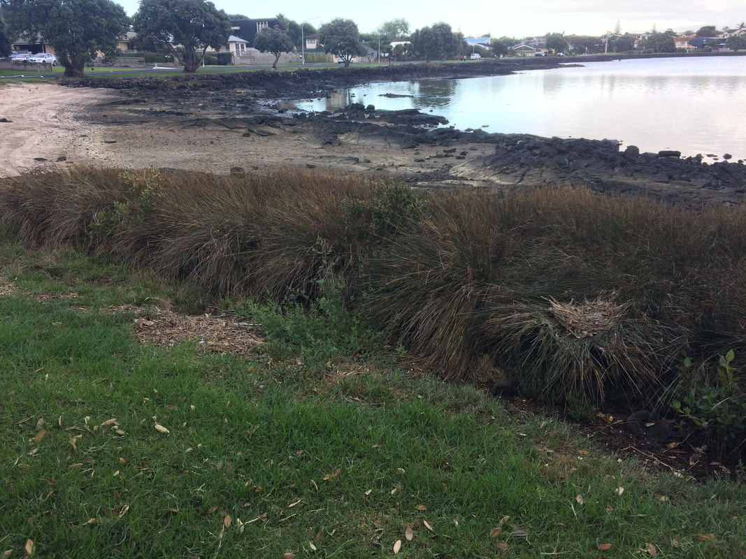
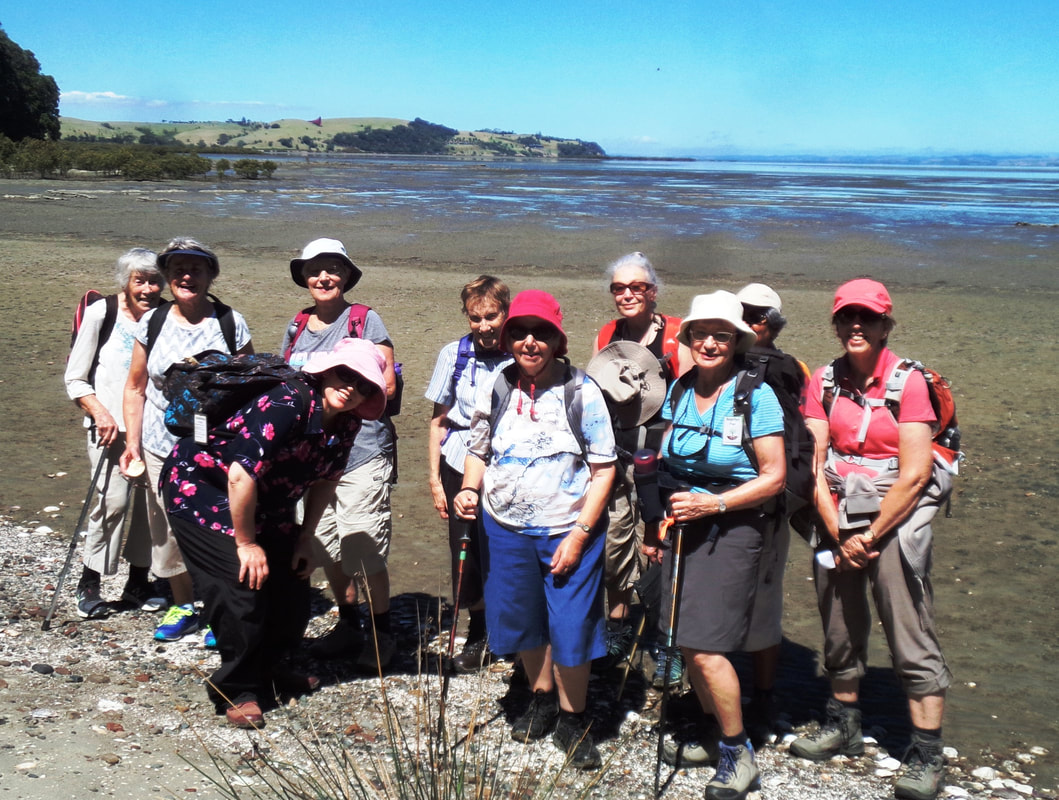
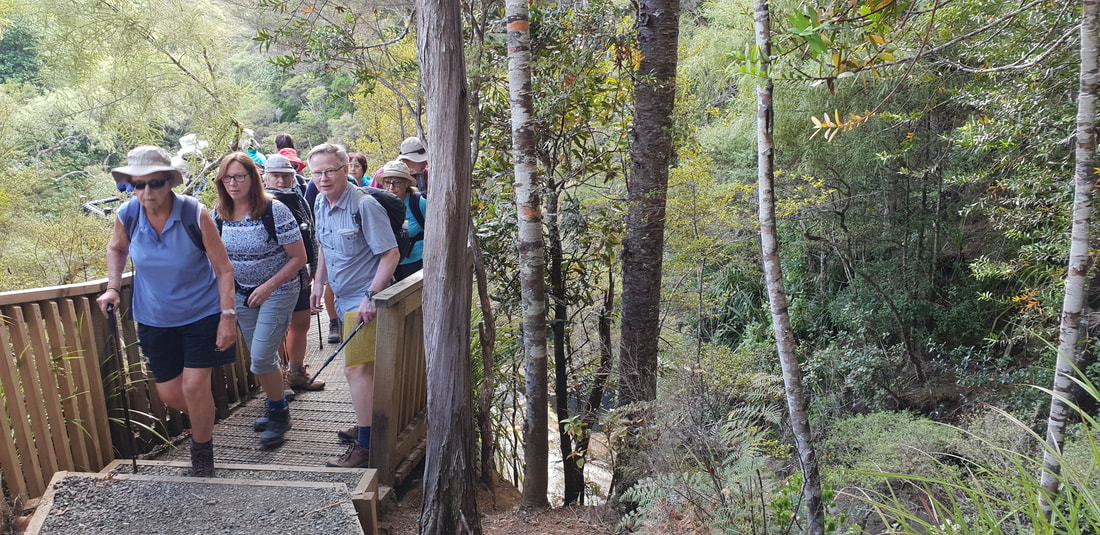
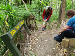
19 walkers stepped off the bus at the junction of Coronation Road and Kiwi Esplanade in Mangere Bridge on a grey, cloudy morning.
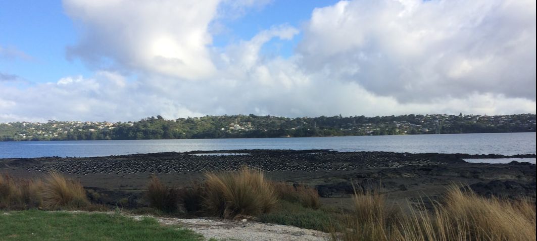
The first segment of our day – Kiwi Esplanade to the entrance of Ambury Regional Park.
The first segment of our day – Kiwi Esplanade to the entrance of Ambury Regional Park.
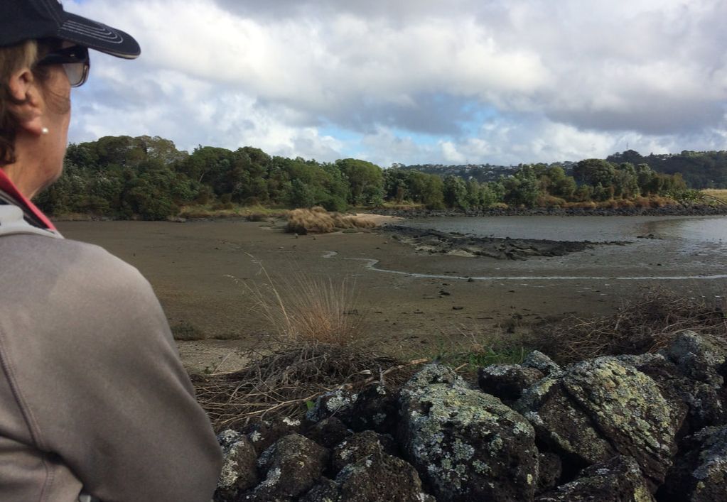
There were many things of interest as we made our way along the coast of the inner reaches of the Manukau Harbour. On our left, were typical residential homes but on our right, we were treated to a completely different scene.
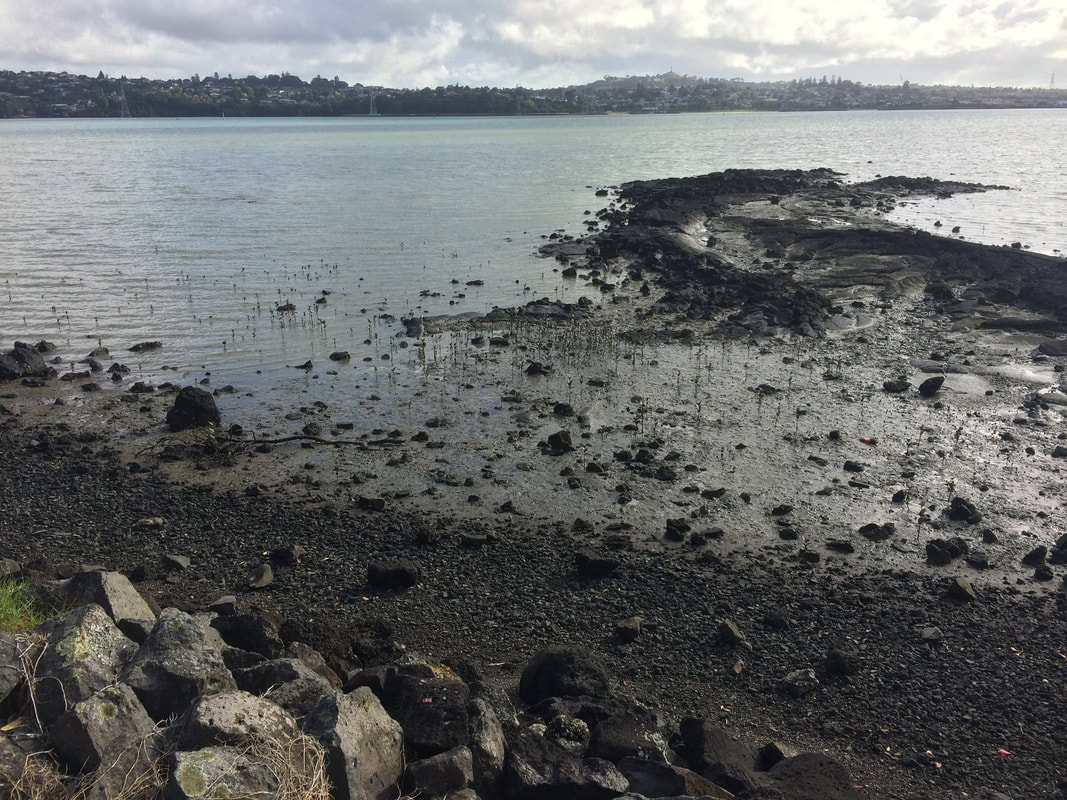
The tide was out and there was evidence of the area’s volcanic history along the length of the foreshore. To help us understand what we were seeing there were several information boards explaining the impact on the landscape of the eruption of Mangere Mountain approximately 30,000 years ago – Pahoehoe lava - basaltic lava forming smooth undulating or ropy masses.
The tide was out and there was evidence of the area’s volcanic history along the length of the foreshore. To help us understand what we were seeing there were several information boards explaining the impact on the landscape of the eruption of Mangere Mountain approximately 30,000 years ago – Pahoehoe lava - basaltic lava forming smooth undulating or ropy masses.
|
|
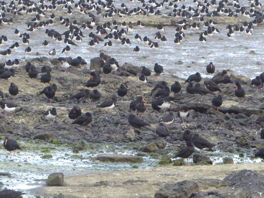
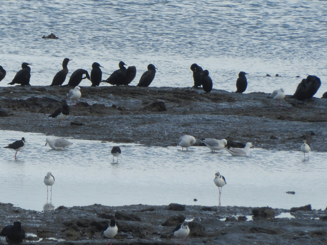
There was also an information board detailing how the harbour provides habitat for international and national migratory wader birds, as well as other local birdlife.
We were fortunate to see hundreds of South Island pied oyster catchers in several spots gathering food from the mud flats. White faced herons and pied stilts were also evident but often difficult to detect because they blended so well into their surroundings.
We were fortunate to see hundreds of South Island pied oyster catchers in several spots gathering food from the mud flats. White faced herons and pied stilts were also evident but often difficult to detect because they blended so well into their surroundings.
|
|
|
As we neared Ambury Park, there were a couple of opportunities for John to show us examples of why the area was known as the “food basket” for Maori and where they used natural fish traps for the smaller varieties. |
Ambury Farm – Foreshore Walk
After passing through the gate into Ambury Farm, we left suburbia behind. We entered into a more remote area with pastures and grassland extending down to the foreshore, and we immediately turned right for the commencement of Ambury’s Foreshore Walk.
After passing through the gate into Ambury Farm, we left suburbia behind. We entered into a more remote area with pastures and grassland extending down to the foreshore, and we immediately turned right for the commencement of Ambury’s Foreshore Walk.
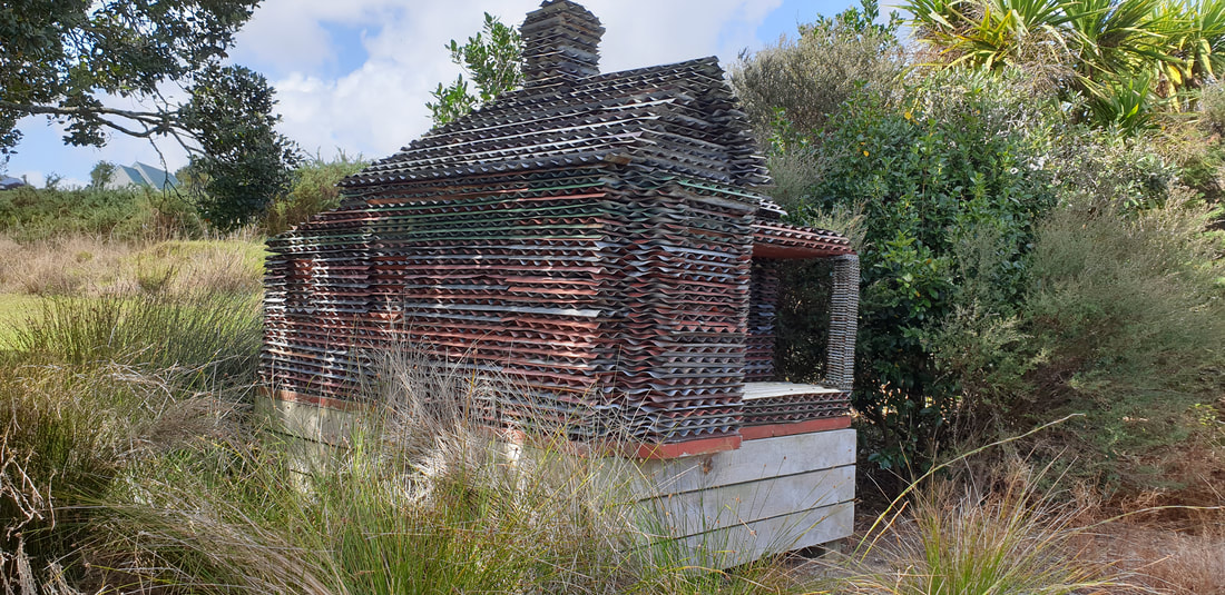
There were markers to follow and information panels were prevalent. About half way around there was a uniquely constructed bird-watching hut - a good spot for a short rest. This part of the coast is known as a significant habitat for shorebirds, although we didn’t see many today (mainly Pukekos!). There were however, many examples of basalt lava flows, including lava tubes.
|
 Margaret & John providing information on lava tubes Margaret & John providing information on lava tubes
|
 Shirley checking the herbs Shirley checking the herbs
|
Salt meadows are a feature of the Ambury Park’s foreshore. When we arrived at a small fenced off area it was obvious there had been attempts to protect and cultivate several saline herbs. They had been provided with wind protection but the lack of recent rain was very apparent. Fiona took the opportunity to give us the definition of a herb - "plant with leaves, seeds, or flowers used for flavouring food, medicine or perfume." She also spoke about sea celery and other herbs, including the plant covering the largest area in the salt marshes - NZ glasswort - a periennal, succulent, halphytic, coastal plant. |
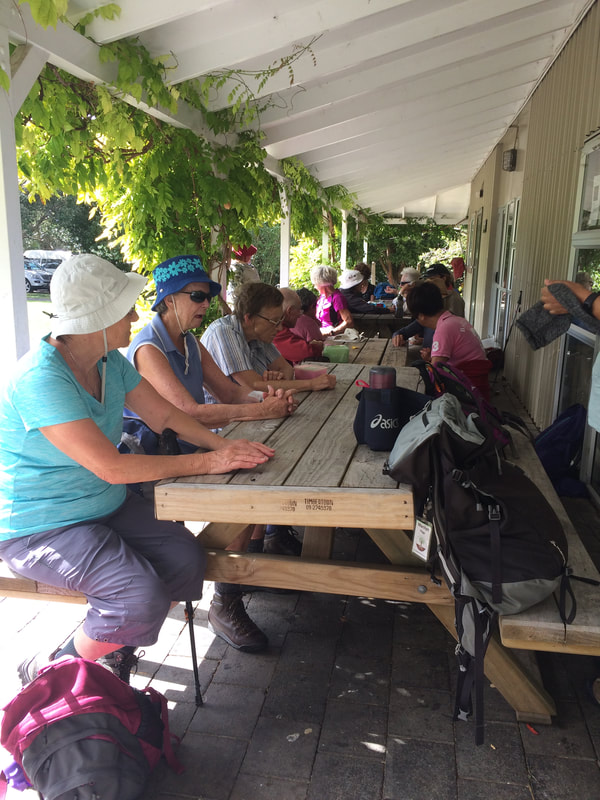
A brief look at the children’s insect garden before we headed to our lunch spot – a covered verandah, complete with tables, at the main complex.
Watercare Coastal Walkway
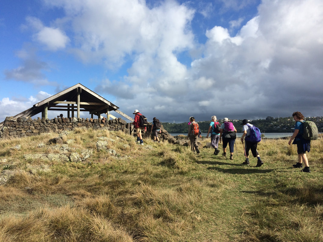
The third segment of our walk – from Ambury Regional Park, down to the bird roost, along the coast and around Mangere Lagoon.
The third segment of our walk – from Ambury Regional Park, down to the bird roost, along the coast and around Mangere Lagoon.
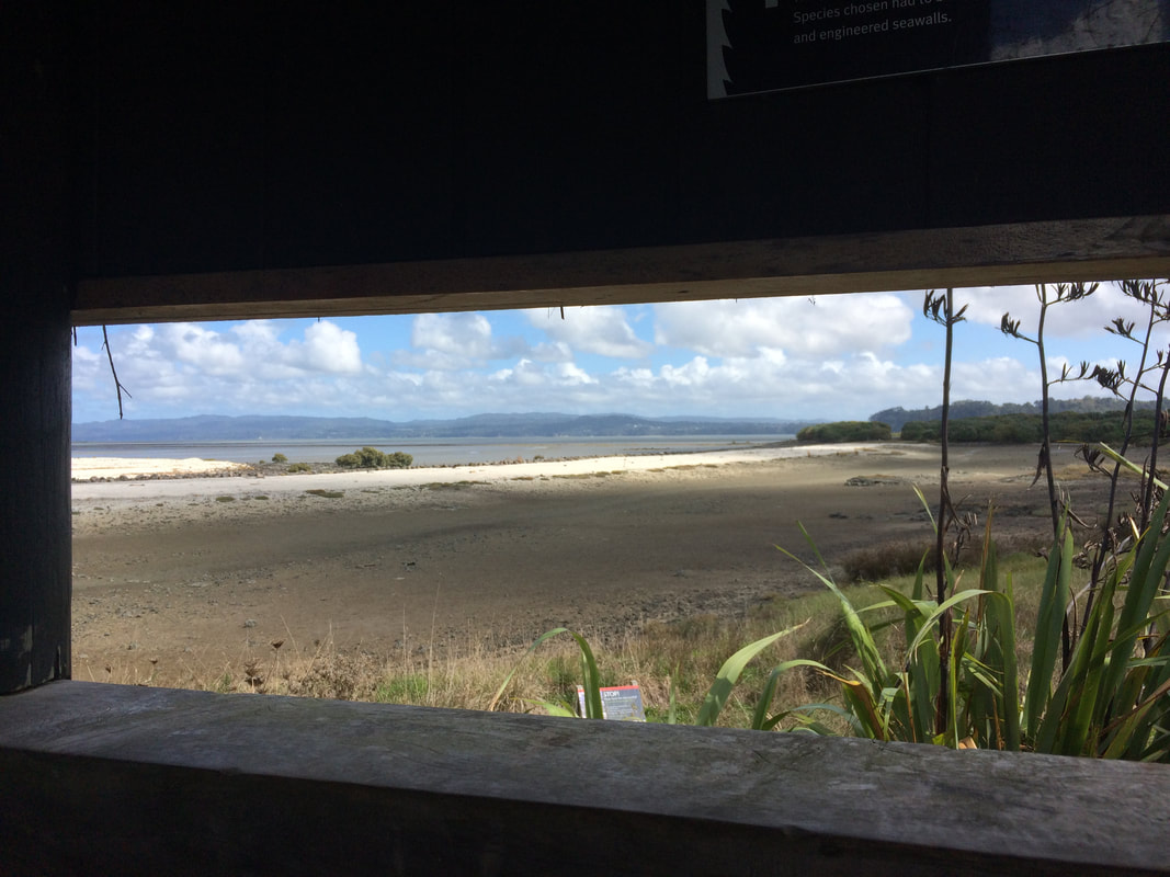
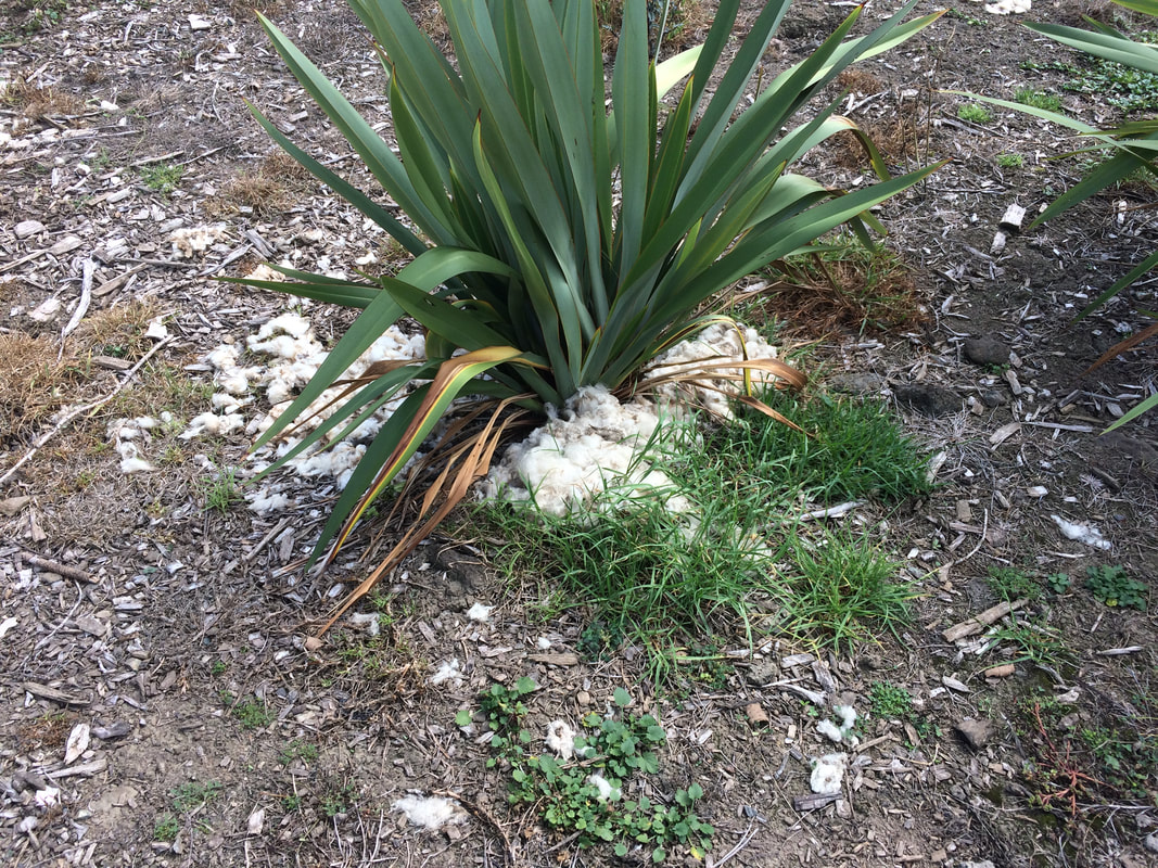
The bird roost was a semi-circular building, with plenty of information about the birds, but alas when we looked out through the viewing slots there were no birds to be seen. I think they were all congregating around the Kiwi Esplanade area! Back onto the track and an unusual sight – sheep’s wool being used as mulch around several plants.
|
|
|
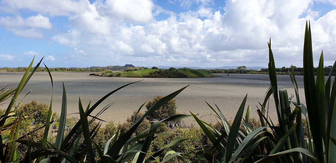
Mangere Lagoon, at the foot of Mangere mountain, is a large explosion crater with a low tuff ring breached to the sea on one side and now occupied by tidal mud-flat. In the centre of the lagoon is the summit of a small scoria cone with a shallow crater. The tide was at its lowest during our walk, the lagoon was devoid of water, and birds were absent too. |
 Mangere Lagoon Mangere Lagoon
|
 Madeira vine Madeira vine
|
The track around the lagoon was very well formed with intensive native planting on both sides. However, we were disappointed to see a rather attractive creeper invading and choking many of the established plants. Sharleen kindly identified it for us as “Madeira vine” or "Mignonette vine", Andredera cordifolia. It is known to smother all plants, medium to high canopy, and prevents the establishment of native plant seedlings. We were pleased to find Okie and the bus waiting for us at Creamery Road carpark. |
Strawberry Farm and The Outdoor Gallery, Auckland Airport
|
A reward for all our hardwork – a stop at the Strawberry Farm for a "very large" strawberry ice cream! Some of us also took the opportunity to buy the very fresh vegetables on sale too. |
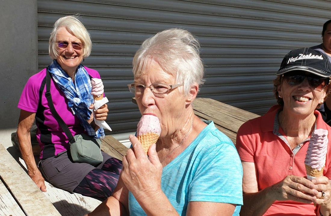 Vivien, Shirley & Anne enjoying their ice creams! Vivien, Shirley & Anne enjoying their ice creams!
|
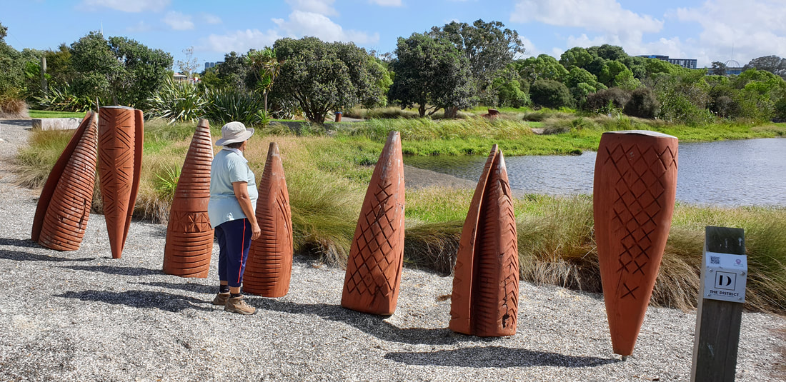
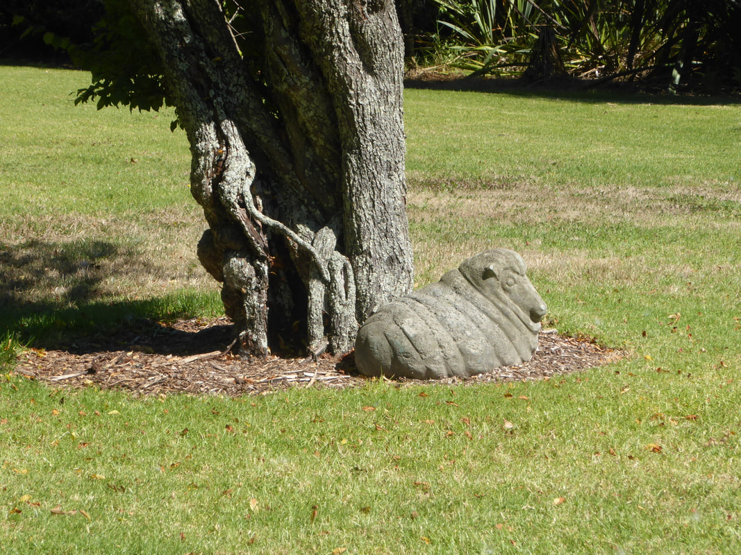
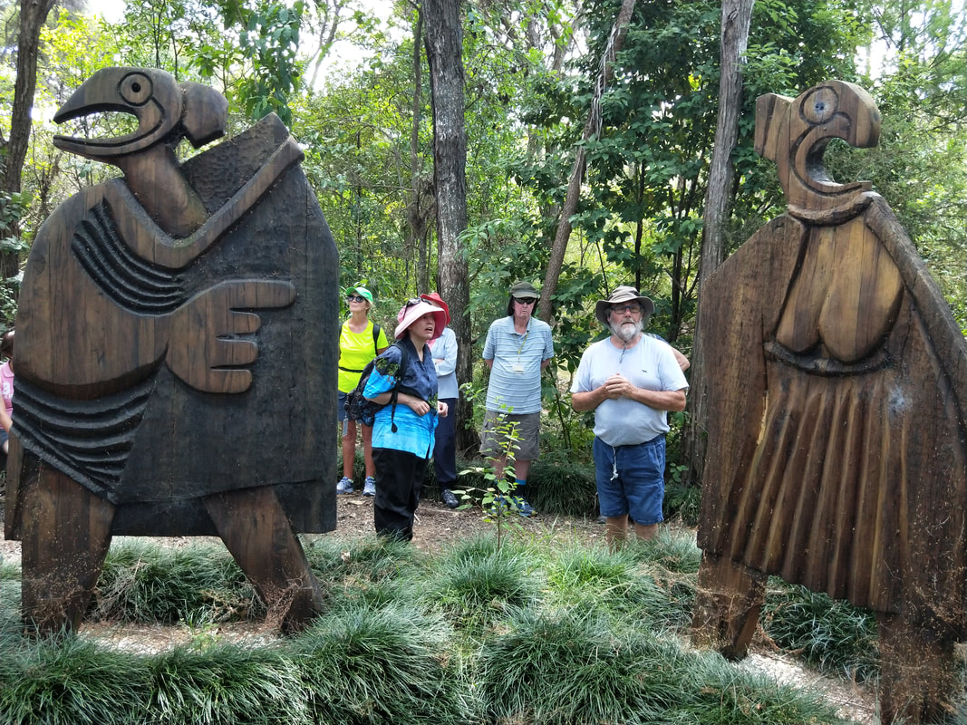
Our final stop, The Outdoor Gallery, situated next door to Butterfly Creek. There were 10 sculptures (created by established NZ artists as well as new talent) displayed in landscaped grounds in and around a wetlands area. A pleasant stroll around well planted walkways.
|
|
A hidden gem and a nice way to end our day.
Many thanks to:
Leaders: Fiona and Linda
Photos: Sharleen and Linda
Text: Linda
Leaders: Fiona and Linda
Photos: Sharleen and Linda
Text: Linda
17 March 2019
Waihi to Homunga Bay
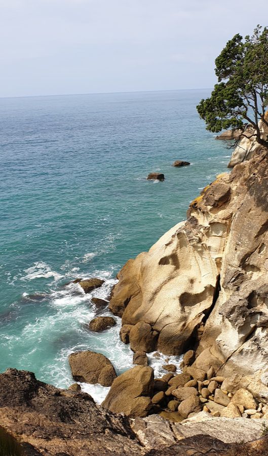
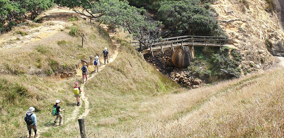
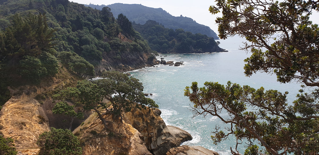
This 12km coastal walk with spectacular views is one to remember and cross off the bucket list if you’re a keen walker.
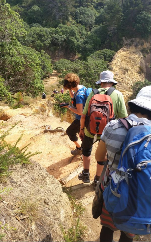
Pohutukawa, nikau and puriri provided shade for us when the sun broke through the clouds but we all needed our two bottles of water nevertheless as this is not a “walk in the park” with steep drops and cliffs along the edge of some track sections.
It was obvious the storm damage and slips of recent years have changed the face of the coastline considerably.
This walk can be done in either direction depending on the tides.
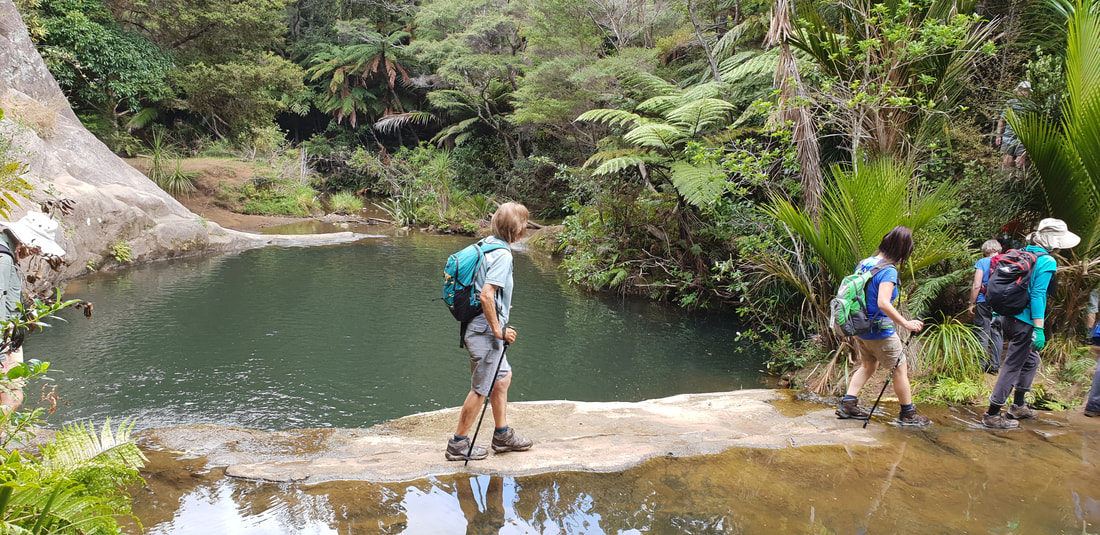
Starting from the northern end of Waihi Beach, the route follows the rugged coastline firstly on the Orokawa Bay Track then the Homunga Bay Track.
Both bays are beautiful unspoilt beaches, not suitable for swimming due to the steep grade of the seafloor, but apparently excellent fishing spots.
That explains why we saw some keen souls making their way downhill with their fishing rods while we toiled uphill with our walking poles!
Both bays are beautiful unspoilt beaches, not suitable for swimming due to the steep grade of the seafloor, but apparently excellent fishing spots.
That explains why we saw some keen souls making their way downhill with their fishing rods while we toiled uphill with our walking poles!

|

|
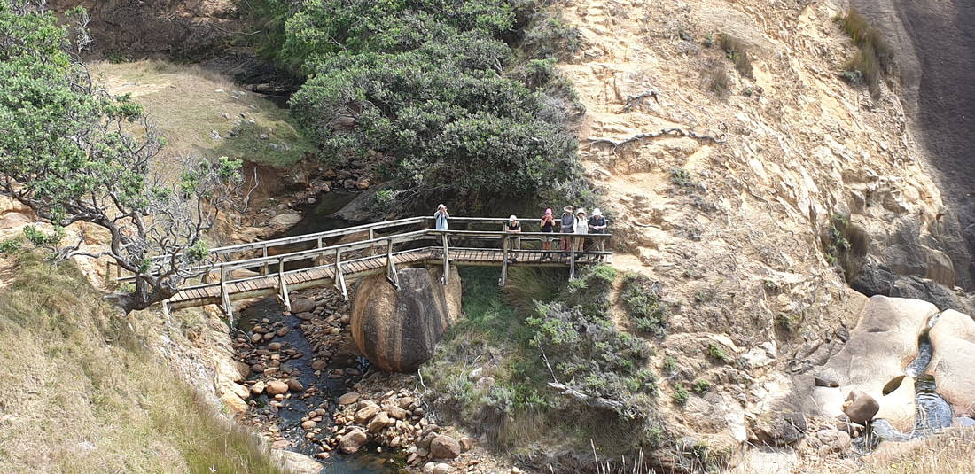
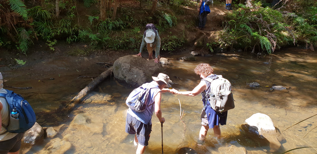
We encountered a “bridge with a difference” en route - built across a stream and supported midway by a huge boulder, see photos.
|
|

|
|
Orokawa Bay was a lovely lunch stop with fallen trees on the sand making comfortable seats for most of us. Further on Homunga Bay’s waterfall inspired some to take an impromptu shower to cool off.
Those who didn’t, decided to walk on in search of some shade for a short rest before the climb up through farmland to our waiting bus at Ngatitangata Rd.
Those who didn’t, decided to walk on in search of some shade for a short rest before the climb up through farmland to our waiting bus at Ngatitangata Rd.
Many thanks to Derek and Don for leading this walk, assisted by Gail and Janet.
Text – Sharleen
Photos – Sharleen, Derek
Text – Sharleen
Photos – Sharleen, Derek
3 March 2019
Mataia One Day Walk
Mataia One Day Walk
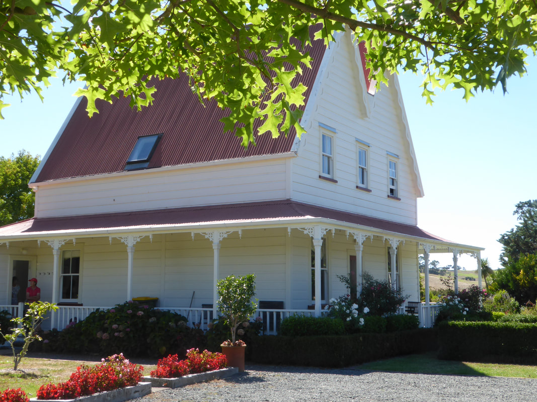
Mataia Homestead is a private establishment located on the Kaipara Coast Highway, Glorit and is 66 kilometres north of the Auckland Harbour Bridge.
This farm is 1600ha in size and the owners have developed a wonderful two-day walk over the landscape. The farm is a blend of a working farm, and intensive conservation restoration project.
This farm is 1600ha in size and the owners have developed a wonderful two-day walk over the landscape. The farm is a blend of a working farm, and intensive conservation restoration project.
For the one day walk, our group was large - 38 in size.
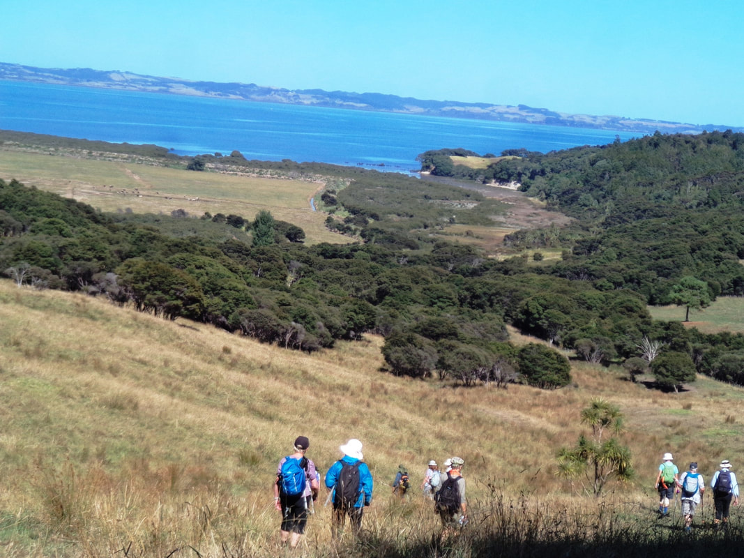
29 trampers took the A walk of 12 kilometres. We were supplied with A3 size aerial maps and an informative sheet to read as we approached each marked area. We started walking across parched dry farm paddocks, and over stiles, before ascending into the pine forest. On entering the QE11 bush, we met an Environmental Officer who had been into the protected bush to check on the welfare of released kiwis. We were told that they are monitoring 40 kiwis in that area.
29 trampers took the A walk of 12 kilometres. We were supplied with A3 size aerial maps and an informative sheet to read as we approached each marked area. We started walking across parched dry farm paddocks, and over stiles, before ascending into the pine forest. On entering the QE11 bush, we met an Environmental Officer who had been into the protected bush to check on the welfare of released kiwis. We were told that they are monitoring 40 kiwis in that area.
Following the orange markers, we walked to Tau Tau Point, 5 kilometres away.
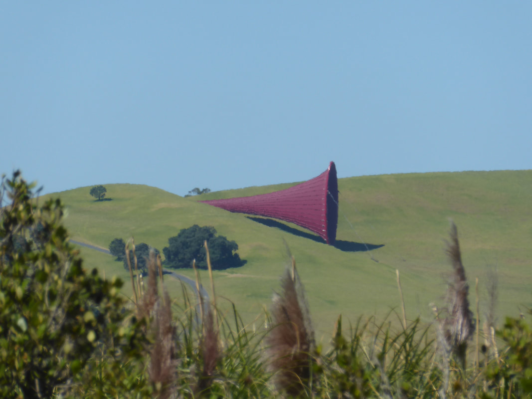
This was our lunch stop. We had hoped to see some bird activity, but alas due to the hot weather, we believe they were resting in the shade. Through the bush, we had wonderful views of the Kaipara Harbour (largest inland harbour in the world). We caught glimpses of the huge sculptures on Gibbs Farm nearby.
This was our lunch stop. We had hoped to see some bird activity, but alas due to the hot weather, we believe they were resting in the shade. Through the bush, we had wonderful views of the Kaipara Harbour (largest inland harbour in the world). We caught glimpses of the huge sculptures on Gibbs Farm nearby.
|
|
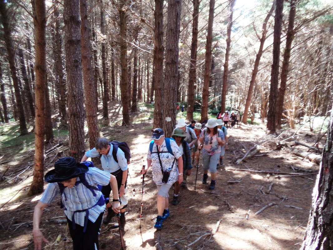
We returned along tracks, wonderfully named as Lemon Tree Gully Track, Peach Tree Gully Track, Fishing Track, and Mataia Creek Track. Each track had its own vegetation, landscape and walking conditions underfoot. We walked over tinder dry farm paddocks, up through pine forests, up and down hardened clay 4-wheel drive tracks, soft mowed grass, through kauri forests and down through virgin bush and alongside coastal wetlands.
|

Native Broom next to Kauri trunk
|
This was a wonderful walk enjoyed by all in bright sunny conditions, and we made it in under 5 hours, with a few minutes to spare.
The B group (9 walkers) enjoyed a less strenuous tramping day. They also explored Mataia Bay coastal area and the farmhouse grounds and gardens.
|
|
Thanks for putting together a great day:
Leaders: Janet and Shirley
Photos: Sue and Praemi
Text: Janet
Leaders: Janet and Shirley
Photos: Sue and Praemi
Text: Janet
17 February 2019
Goldie Bush tracks

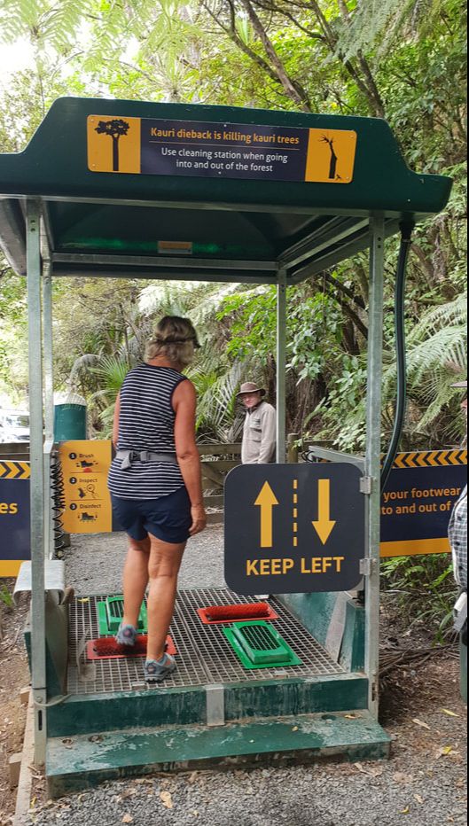
DOC has done a wonderful job of upgrading this area to kauri-safe standard and we were thrilled at its recent re-opening. Tracks have been widened and shingled with some re-routing with boardwalks past vulnerable kauri. Excellent new hygiene stations are at each end of the tracks and kauri dieback education signs appear generously at intervals as reminders to stay on the track.
There are walks to suit everyone here, we even saw a number of young families with toddlers and babies.
Our big group of 34 walkers began our day at the Horsman Rd entrance to the bush and ended at Constable Rd. What a pleasure to be walking in the Waitakeres again in the cool shade on a hot day.
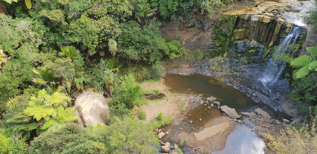
The lookout platform above Mokoroa Falls gave us a good view of the waterfalls and even though Auckland hasn't had much rain for a while, there was still a reasonable flow. We took the steps down to the bottom of the falls and had a good look round the base of the falls - a different perspective.
From the falls we split into two groups - some retraced their steps back up onto Goldies Bush Walkway which proved to be a good workout for the knees and hips but with plenty of bonus sights - the rare and impressive three- trunked kauri and some with twin trunks as well.
And mustn't forget the old log race pointed out by John earlier on, a reminder of kauri logging days gone by.
Lots of opportunities for botany stops and just to admire the surroundings.
A lovely walk with all the steps taken at a leisurely pace.

|

Vanessa, Linda & Kanako
|
The rest of us chose to take the challenging Mokoroa Stream Track and soon realised that we were going to have soggy feet and boots all day - and would need to be very focussed to stay upright on the slippery river crossings and scrambly banks. Tree roots and our trusty walking poles our best friends today.
We zig-zagged our way downstream (crossing the stream around twenty times) following the marked track. No lovely wide gravelled track for us and certainly not a track to be attempted after heavy rain.
We were fortunate the river water level was very low this time of year and the weather was perfect.
The bush was stunning, alive with a cicada orchestra, and a photographer's dream.
A day to remember for sure.
With thanks to Anne and Don, our leaders, and to John, Jennifer and Janet for their help.
Text: Anne and Sharleen Photos: Molly and Sharleen
With thanks to Anne and Don, our leaders, and to John, Jennifer and Janet for their help.
Text: Anne and Sharleen Photos: Molly and Sharleen
03 February 2019
Waiheke Island: Dead Dog Bay and Kuakarau Forest
A ferry crossing on the sparkling Hauraki Gulf then a dash for a couple of local Waiheke buses and we could relax and enjoy the ride to the Te Whau Peninsula and our first walk of the New Year, all 43 of us!
An easy track through the Kuakarau Forest Reserve was a nice warmup (if we needed warming up on this hot summer day). Molly gave us some of the history of the forest and some enlightenment on the plentiful nikau surrounding us. Surprising how slow-growing they are and how to tell their age from the scars on the trunks. There are also many magnificent old puriri in this remnant forest.
The track emerged at Kuakarau Bay and Mary Wilson Reserve, a quiet and peaceful place for morning tea under the trees. Retracing our steps through the forest (uphill this time) and out onto Te Whau Drive, it was then a short walk on the roadside to Vintage Lane and its famous views out over the water to Kennedy Point. Quite a steep descent down the road and then to the beach with some loose shingle underfoot.
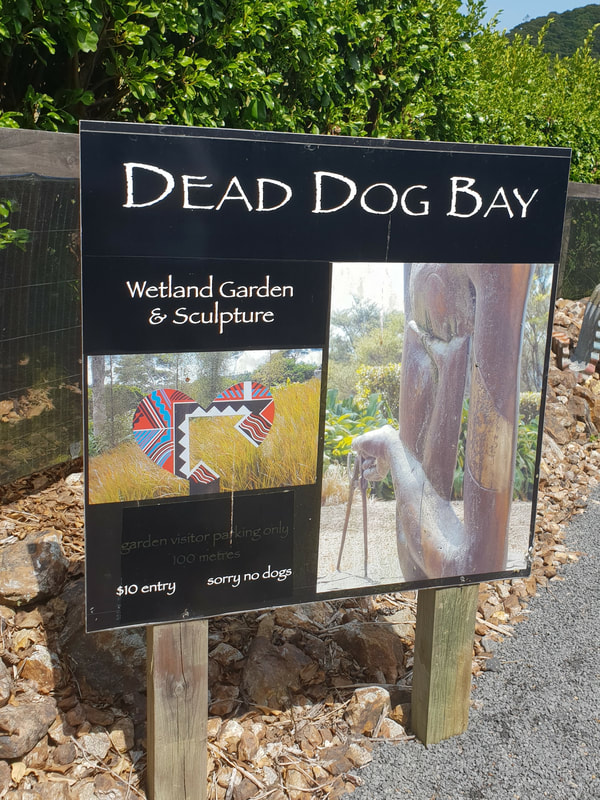
Dead Dog Bay Wetlands and Sculpture Garden was next. (The bay is also known as Okoko Bay and has a lively history concerning massacres and land sales). The Dead Dog name is not as dramatic as we had wondered.
Heart 'X' - Para Matchitt
|

Giant Pukeko - Ricks Terstappen/William Jamieson
|
The gardens property covers a large area and contains an entire eco-system from a freshwater stream, forest, wetland, lagoon and seashore, and is designated an area of Special Ecological Significance in the Hauraki Islands Plan. The wetlands are monitored for rare bird species - spotless crake and fernbirds and dotterels nest here.
A colourful favourite for some of us.
|
Titama He Taneata (The argument) - Arnold Wilson
|
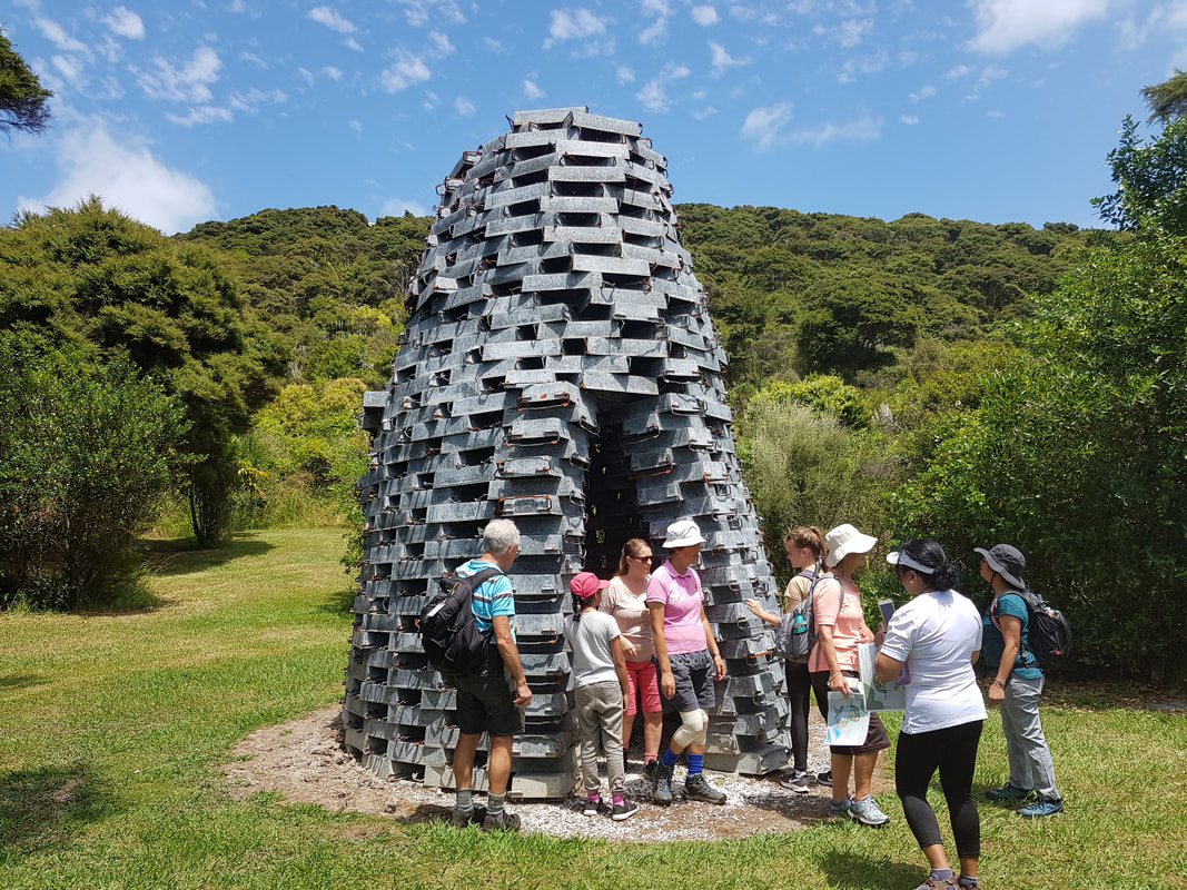 Ricks Terstappen - Tower
We were given a guided tour by Lance Peterson, who with wife Kay, developed the garden and now display their interesting and sometimes quirky sculpture collection. Useful maps provided had a list of the artworks and their locations on the back so we could work out the "who and what" of the works that especially took our eye.
Some of our group did a bit of bush whacking into the "Untouched Forest" track on the property while others decided that lying about under some shady trees for a bit was justified before the walk back uphill to the bus stop.
Thanks to Molly and Sharleen for organising the day. And thank you to everyone for not saying you were hot or tired, even though you were!
Text: Sharleen
Photos: Cheryl, Jennifer and Sharleen
Text: Sharleen
Photos: Cheryl, Jennifer and Sharleen