Trip Reports: July - August 2018
August 19 - Karekare to Whatipu
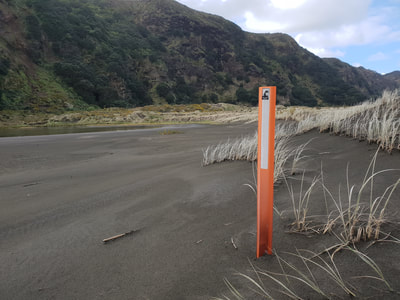
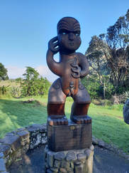 The Pou
On a sunny but fresh August morning before our group set off to follow the route the old steam trains took transporting kauri timber to the sailing ships at the Whatipu wharf, we took time to admire the pou. This carved pou symbolises the spiritual guardianship of Te Kawerau a Maki, the Tangata Whenua.
It also recognises that Karekare is a special place to be enjoyed and respected by all. Then through beautiful Pohutukawa Glade stopping to inspect the conglomerate cliff of the tuff ring of Karekare’s “explosive crater” -- part of the enormous ancient Waitakere volcano some 20 miles out to sea.
Then onto the beach and moving south to discover a few of the original iron spikes which had anchored the rails to a rock shelf section of the track.
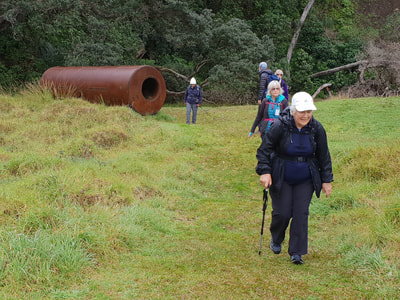
Still following the Hillary Trail we continued to Tunnel Point, the track now close to the cliffs and behind the sand hills which had gradually built up between the railway and the shore over the last 100 years. The rusting boiler which was too large to fit through the tunnel was still lying there abandoned on the south side.
Morning tea here and rain coats on because our sunny day had now changed to rain.
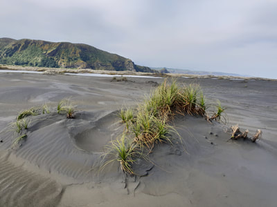
From here on it was away from the cliffs and out onto the shoreline, thereby observing the rahui on kauri dieback and avoiding the sensitive inland area.
Presently we saw a young seal galloping in an ungainly manner down to the water to get away from twenty-two strange human creatures coming along the beach towards it.
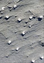 spiral ram's horn shells
Several times we came across areas in the sand with spiral ram’s horn shells.
These shells come from very small squid and consist of a coil of pearly compartments which the animal uses as a buoyancy aid. The squid fills the compartments with air or water in order to adjust its depth.
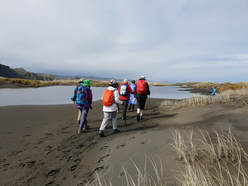
Eventually we changed course a few degrees west, shortening the distance a bit by ‘cutting the corner’ and presently stopping for lunch on a sand hill.
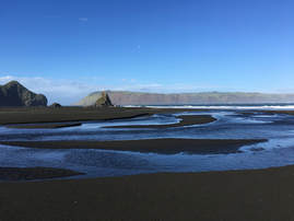
From there we could clearly see out to the breakers on the Manukau Bar and closer in the blue of the main channel going north out into the Tasman Sea.
After lunch we set our sights for the Ninepin Rocks and continued on past to view the remains of the Whatipu wharf in the shelter of Paratutae Island at the entrance to the Manukau Harbour.
Finally, In the parking area at Whatipu was the welcome sight of Joe, our driver, who was patiently waiting there for us with the bus. Altogether we had a great day walking along Auckland’s wild west coast with all its secrets. Although this was not an officially recognised walk as such we felt we had done something special, something few Auckland people even know about.
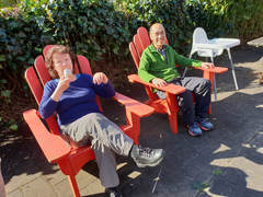 Molly and Kevin
Did I mention ice creams at the Huia store on the way home?
Many thanks to:
Leaders: John & Elane
Text: John
Photos: Sharleen, Kevin
For more photos follow this link to an album created by one of our great photographers, Molly
sway.office.com/aCMQdV1MyLmJU2Lo?ref=email
August 05 - Beach Haven
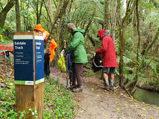 A raincoat day!
The loss of tracks in the Waitakeres sets us off in different directions to find new places to explore. Today’s walk took us to a number of tracks and reserves in the Kaipatiki quarter.
The first section took us through Birkenhead Domain/Eskdale Reserve. The bus dropped off our group of twenty one at Glenfield Rd opposite Speedy Crescent. This section of road was once popular for would-be car sellers to line their vehicles along the road but this is no longer permitted.
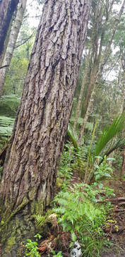 Amazing bark!
We started at 9:20, heading down into the domain on soft grass squelchy from the recent rain, and headed over to the right where our track began. The tracks are not well sign-posted but we knew to head in the direction of Eskdale Rd.
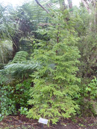
We passed stands of nikau, and a lot of young karaka with the occasional wheki.
Featuring in this reserve were maritime pine with their distinctive heavily grooved bark.
Less than an hour into the walk we paused at a small waterfall for a morning tea stop. A tyre was suspended over the stream that would be fun for local children to play on.
At 11am we reached the busy Kaipatiki Rd having completed our traverse of the Eskdale reserve.
Crossing the road took us to a track that followed alongside the road covered in layers of soft brown oak leaves, and occasional pink puriri flowers.
This took us to the second section of our walk up through Witheford Scenic Reserve to Manuka Rd. The terrain is steep and some preferred to take the “short cut” up a steep road while others enjoyed the undulating tracks through bush and a short steep road section to find the others waiting for us on Manuka Rd.
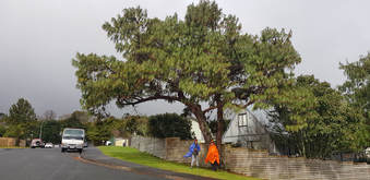
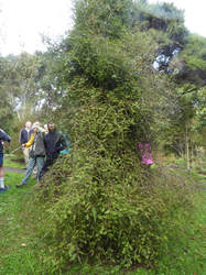
From there we headed down Leigh Terrace and Morriggia Place looking forward to seeing the largest kauri on the North Shore. But alas, during the two weeks since the recce, this track had been closed off due to kauri dieback recently discovered in Birkenhead. At this point a few of the group felt unable to complete the remainder of the walk and the bus was summoned to pick up six who elected to return. The rest of us headed down to Lynne Reserve for a lunch stop, and from there to Manuka Reserve. En route we spotted an interesting tree – the Mexican weeping pine.
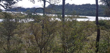 Hellyers Creek
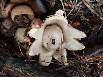
The final section of the walk took us around the Manuka Coastal area which is steeped in history. This took approximately an hour of scenic track, overlooking Hellyers Creek. We saw a patch of curious white fungi that one of the group identified as Geastrum fungi - also called earthstars. They split into a star or flower pattern to let their spores out.
This walk is a loop that returns back to Kaipatiki Rd. And from there it was a 20 minute walk back to the bus that was waiting for us on Cresta Rd.
Many thanks to:
Leaders: Don & Jennifer
Text: Jennifer
Photos: Jennifer, Derek and Sharleen
Leaders: Don & Jennifer
Text: Jennifer
Photos: Jennifer, Derek and Sharleen
July 22 - North Shore Gems
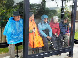
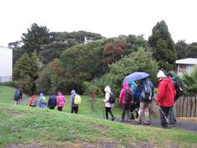
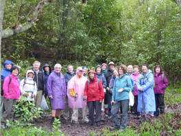 The brave group who put up with the rain.
Hard to believe that Kauri Glen & Cecil Eady Bush in Northcote, a beautiful bush valley and a reserve since 1907 is just one block off busy Onewa Road. After a short walk up Lake Road 22 walkers entered a small stand of bush that led us to the park entrance.
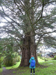
With the serious concerns around kauri die-back, walkers had been pre-warned to ensure their boots were immaculately clean. As an extra safe-guard, all boots were thoroughly sprayed as we entered the park. Although the forest was milled for kauri, some large trees of 200-300 years remain - who would want to be the cause of their demise!
With the serious concerns around kauri die-back, walkers had been pre-warned to ensure their boots were immaculately clean. As an extra safe-guard, all boots were thoroughly sprayed as we entered the park. Although the forest was milled for kauri, some large trees of 200-300 years remain - who would want to be the cause of their demise!
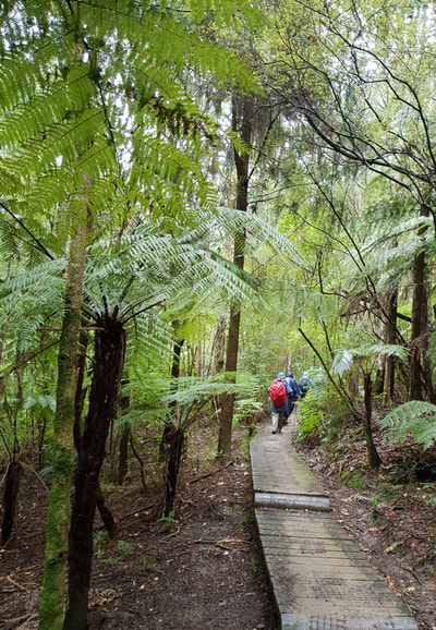
We crossed the bridge over Onepoto Stream and made our way onto the boardwalk leading toward the southern side of the valley. With the amount of rain that we had recently experienced, the boardwalk was a little slippery (and overgrown) but fortunately there were no mishaps. The vegetation was lush and the stream was full.
We continued along the southern ridge and made our way across an extremely muddy paddock before taking a break for morning tea at the lookout - a large laminated board identifying the trees and plants in immediate view.
On reflection, the park has it all - leading down to the stream were nikaus, tree ferns, dracophyllums, kowhai and kiekie. Around the stream banks were miro, puriri, kohekohe and taraire and on the higher ridges were kauri, tanekaha, kanuka, rewarewa, totara and rimu. Hard to believe - Google shows we were just 7.6k m from Britomart!!
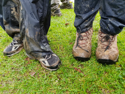
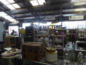
Despite the mud and slippery conditions we made good progress and when we completed the loop and exited the park, we had some time to spare. So we took the opportunity to look at “Junk & Disorderly” (conveniently located on the street where the bus was parked!). The group had no problem spending time perusing the huge warehouse full of bric-a-brac and "junk" from days gone by and were delighted to discover the coffee cart parked in the driveway!
A change of footwear, or boots wrapped in plastic bags, and we were all back on the bus heading 4 km west to Fernglen Native Plant Gardens in Birkenhead.
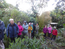 Listening attentively to Malcolm.
Fernglen, a 12 acre property, was purchased by the Fisher family in 1888. Since the 1920's it has been used for education and research. It was acquired by the Council in 1989 and was partially gifted by Muriel Fisher. Muriel wrote many books on NZ plants and received the Queen's Service Medal for her contribution to education in the field of flora. Fernglen is devoted to growing and preserving NZ plants. It includes two 300 year old Kauri, ancient rimus, many rare and endangered plants, including an Offshore Island Collection.
We received a warm welcome - the Education Centre had been unlocked for us, a heater turned on and an urn ready for tea/coffee. This was our lunch stop and Malcolm Fisher (Muriel's son) was anticipating our arrival. Malcolm had offered to spend a couple of hours with us. He started with a video and discussion mainly focusing on the impact of the construction of the Harbour Bridge on the North Shore landscape and his parents’ development of the gardens.
He then led us outside to the areas adjacent to the Education Centre - sub-alpine and rock gardens containing many of the rare and unusual plants that Fernglen is renowned for. It immediately became obvious how much Malcolm had learned from his parents over the years. We enjoyed hearing how many of the plants came to be at Fernglen, how the family travelled extensively to visit other "plant people" to pick-up plants, cuttings, etc.
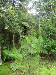
Next stop, The Fern House - not large but containing an extensive collection, many of which are clinging to the ponga walls. It was built by Malcolm's father (Bill) when he was looking to create the right environment for growing the Prince of Wales Feathers fern.
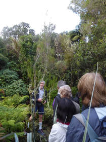 Malcolm took us on an extensive tour!
We then made our way down the kauri ridge to the boardwalk crossing the stream. The features here were the nikau palms and Parataniwha (also called the NZ begonia) that was growing prolifically along the banks.
A few ascending steps and we were making our way up out of the valley to Ben's Ridge, being regenerated with native trees, a variety of coprosmas, as well as a collection of grasses. They were planted in 2003 and are slowly starting to fill the space.
After completing "the loop" on Ben's Ridge, we followed the Canal Track down to the old swimming hole. In the first half of last century it was used as a reservoir for glasshouse irrigation as well as a swimming pool. Malcolm mentioned that his father had been a Scout Leader - the scouts had helped with developing the track and in turn made good use of the swimming hole. Alas, no longer suitable for swimming!
Time to venture back up the slope to the Education Centre where we had left our packs. Molly thanked Malcolm for sharing his family stories, as well as his extensive knowledge of the gardens, and we were on our way up Kauri Road to find the bus. The Club made a donation to Fernglen in recognition of Malcolm's contribution to the day.
Thanks to Molly and Linda for a most enjoyable, well organised day .
Text: Linda; Photos: Praemi and Sharleen.
Text: Linda; Photos: Praemi and Sharleen.
July 08 - Beachlands-Maraetai Walkway & Ayrlies Wetland
Easy walks today and a chance to stretch our legs and blow out the cobwebs by the sea. Twenty one of us climbed off the bus, organised ourselves and set off from the coastal village of Maraetai, following the excellent paved pathway to Beachlands, 6km away. Along the way we climbed up to a lookout in Omana Regional Park which gave us views out over the islands of the Gulf. Studying the map at the lookout answered some questions as to which island was which!
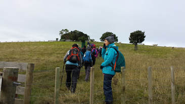 Just a gentle climb to the lookout
Along Kelly’s Walkway (named after former landowners the Kelly family) a couple of info boards complete with heritage photos gave us some background to the area – Duck Bay has an interesting history of the transport by barge of farm animals to and from Waiheke Island in days gone by.
It was a pity there was no sunshine to demonstrate how the imaginative mosaic sun clock works but we could admire the workmanship and creativity of the design, especially the native birds incorporated into it. Similarly we were impressed with the pou constructed at the sacred burial site at Te Puru Park. Carved from a totara, the pou depicts the four corners and winds of the world and was erected after the discovery of human remains during excavations for the sports field.
Finally we exited through Leigh Auton Reserve, walked a short way along the road then a quick detour down to the seashore where a boardwalk took us to a secluded beach (when the tide is out).
By now a persistent light drizzle had materialised and we were happy to get back on the bus and drive on to Ayrlies Wetland near Whitford. Our driver, Oke, very kindly allowed us to eat lunch on the bus (so long as we weren’t messy!).
By now a persistent light drizzle had materialised and we were happy to get back on the bus and drive on to Ayrlies Wetland near Whitford. Our driver, Oke, very kindly allowed us to eat lunch on the bus (so long as we weren’t messy!).
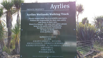
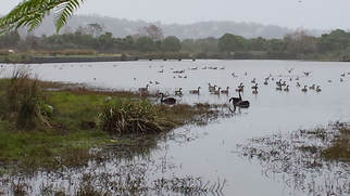
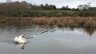
We had never visited Ayrlies Wetland before and it was a delightful 45 minute loop walk through and across the lakes, boardwalks and gravel paths all the way, then a short traverse of farmland and into an area of native plantings. We were thrilled to see young kauri thriving here and had the thought that in spring and summer this would an even more beautiful place to visit. The birdlife was prolific, swans both black and white ones, our native grebe (dabchicks), white-faced herons, shags, many varieties of ducks. With the help of a guidebook we identified some of them. We looked for scaup but couldn’t spot any, something for another day.
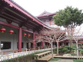 Fo Guang Shan buddhist temple
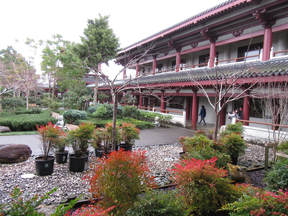
The last stop for the day was at the Fo Guang Shan temple in Flat Bush. This is the largest Buddhist temple in New Zealand and is a magnificent building designed in the Tang dynasty architectural style. Open to non-buddhists, it is also a facility for community programmes and has a very popular teahouse and cafe – so popular that it was too busy for us to have an anticipated cup of lotus tea!
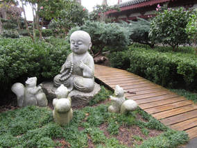
After a wander through the peaceful zen gardens and exhibitions we were ready for home and a new week.
Thanks to Elane and Sharleen for a day that was a bit different and varied!
Text: Sharleen
Photos: Sharleen,
